Laurel Mountain, Pennsylvania facts for kids
Quick facts for kids
Laurel Mountain, Pennsylvania
|
|
|---|---|
|
Borough
|
|

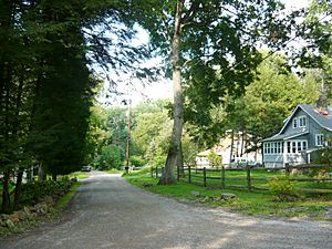
Locust Street
|
|

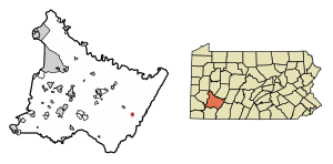
Location of Laurel Mountain in Westmoreland County, Pennsylvania.
|
|
| Country | United States |
| State | Pennsylvania |
| County | Westmoreland |
| Settled | 1926 |
| Incorporated | 1982 |
| Government | |
| • Type | Borough Council |
| Area | |
| • Total | 0.13 sq mi (0.33 km2) |
| • Land | 0.13 sq mi (0.33 km2) |
| • Water | 0.00 sq mi (0.00 km2) |
| Elevation | 1,421 ft (433 m) |
| Population
(2020)
|
|
| • Total | 146 |
| • Density | 1,131.78/sq mi (436.81/km2) |
| Time zone | UTC-5 (Eastern (EST)) |
| • Summer (DST) | UTC-4 (EDT) |
| Zip code |
15655
|
| FIPS code | 42-41834 |
| Website | Official borough website: http://laurelmountainboro.wordpress.com |
Laurel Mountain is a small town, called a borough, located in Westmoreland County, Pennsylvania, United States. In 2020, about 146 people lived there.
This borough sits at the base of Laurel Mountain, which is about 2,800 feet (853 meters) high. The area is known for its many limestone caves. It's also a great spot for outdoor fun like skiing, hiking, and other activities.
Contents
History of Laurel Mountain
Early Land Ownership
The land where Laurel Mountain is today was first bought on July 28, 1769. Richard and Thomas Penn bought it from members of the Iroquois Confederacy. This purchase was part of a much larger area that now makes up a big part of southwestern Pennsylvania. The cost for this huge land deal was ten thousand dollars.
Developing the Community
In the early 1800s, a man named Alexander Johnson received a special document from Pennsylvania. This document, called a patent, gave him ownership of 724 acres of this land in 1815. This large piece of land included the area that would later become Laurel Mountain.
About thirty years later, on May 27, 1843, Joseph Naugle bought 283 acres of Johnson's land. He built a home there, which helped start the new community.
A Vacation Spot
By the early 1900s, Laurel Mountain became a popular place for summer vacations. Business and community leaders from Pittsburgh would come here to relax. On September 1, 1944, a company called Laurel Mountain Park, Inc. was formed. Its job was to manage the fun activities and facilities in the growing community.
Becoming a Borough
Laurel Mountain officially became a borough on December 21, 1979. This decision was approved by the Westmoreland Court of Common Pleas. The first local government, called the borough council, was set up in January 1982.
Geography of Laurel Mountain
Laurel Mountain is located at 40°12′41″N 79°11′4″W / 40.21139°N 79.18444°W. This means it's in the northern hemisphere, west of the prime meridian.
According to the United States Census Bureau, the borough covers a total area of about 0.1 square miles (0.3 square kilometers). All of this area is land, with no water.
The borough is found in the southern part of Ligonier Township.
Population and People
| Historical population | |||
|---|---|---|---|
| Census | Pop. | %± | |
| 1990 | 195 | — | |
| 2000 | 185 | −5.1% | |
| 2010 | 167 | −9.7% | |
| 2020 | 146 | −12.6% | |
| Sources: | |||
In 2000, there were 185 people living in Laurel Mountain. These people lived in 78 households, and 56 of these were families.
The population density was about 1,347 people per square mile (520 people per square kilometer). There were 109 homes in the area.
Everyone living in the borough in 2000 was White. About 1.62% of the population was Hispanic or Latino.
Household Information
- About 26.9% of households had children under 18 living with them.
- Most households, 61.5%, were married couples living together.
- About 6.4% of households had a female head with no husband present.
- About 28.2% were not family households.
- 24.4% of homes had only one person living there.
- 11.5% of homes had one person aged 65 or older living alone.
The average household had 2.37 people. The average family had 2.80 people.
Age and Income
The people in Laurel Mountain had different ages:
- 19.5% were under 18 years old.
- 5.9% were between 18 and 24.
- 27.0% were between 25 and 44.
- 25.4% were between 45 and 64.
- 22.2% were 65 years or older.
The average age in the borough was 44 years.
In 2000, the average income for a household was $44,750. For families, the average income was $63,125. Men earned about $51,250, while women earned about $30,833.
The average income per person in the borough was $21,564. About 13.2% of families and 20.0% of the total population lived below the poverty line. This included 36.4% of those under 18 and 6.5% of those 65 or older.
See also
 In Spanish: Laurel Mountain (Pensilvania) para niños
 | Bayard Rustin |
 | Jeannette Carter |
 | Jeremiah A. Brown |


