Laureldale, Pennsylvania facts for kids
Quick facts for kids
Laureldale, Pennsylvania
|
|
|---|---|

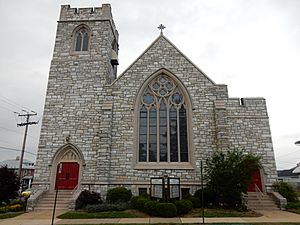
Rosedale United Church, built in Laureldale in 1928
|
|

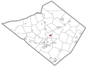
Location of Laureldale in Berks County, Pennsylvania
|
|
| Country | United States |
| State | Pennsylvania |
| County | Berks |
| Area | |
| • Total | 0.81 sq mi (2.10 km2) |
| • Land | 0.81 sq mi (2.10 km2) |
| • Water | 0.00 sq mi (0.00 km2) |
| Elevation | 400 ft (100 m) |
| Population
(2020)
|
|
| • Total | 4,277 |
| • Density | 5,280.25/sq mi (2,039.80/km2) |
| Time zone | UTC-5 (EST) |
| • Summer (DST) | UTC-4 (EDT) |
| ZIP Code |
19605
|
| Area codes | 610 and 484 |
| FIPS code | 42-41768 |
Laureldale is a small community called a borough in Berks County, Pennsylvania, in the United States. In 2020, about 4,277 people lived there.
Contents
Laureldale's Location and Size
Laureldale is a compact area. It covers about 0.8 square miles (which is about 2.1 square kilometers) of land. This means it's a relatively small town in terms of its physical size.
Who Lives in Laureldale?
Population Changes Over Time
The number of people living in Laureldale has changed over the years. Here's a quick look at how the population has grown and shrunk:
- 1940: 3,397 people
- 1950: 3,585 people
- 1960: 4,051 people
- 1970: 4,519 people
- 1980: 4,047 people
- 1990: 3,726 people
- 2000: 3,759 people
- 2010: 3,911 people
- 2020: 4,277 people
Diversity in Laureldale
In 2010, there were 3,911 people living in Laureldale. Most residents (about 86.8%) were White. There were also people from other backgrounds, including 2.5% African American, 0.4% Native American, and 0.9% Asian. About 6.8% of the population identified with other races, and 2.7% identified with two or more races. Around 16.1% of the people living in Laureldale were of Hispanic or Latino heritage.
Getting Around Laureldale
Roads and Travel
As of 2006, Laureldale had about 15 miles (24 kilometers) of public roads. Most of these roads, about 13.17 miles (21.2 kilometers), are taken care of by the borough itself. The remaining 1.91 miles (3.1 kilometers) are maintained by the Pennsylvania Department of Transportation (PennDOT).
Main Streets and Nearby Highways
No major highways pass directly through Laureldale. The two most important roads in the borough are Kutztown Road and Elizabeth Avenue. These two roads meet near the center of town. If you need to get to a larger highway, U.S. Route 222 Business is just west of Laureldale.
See also
 In Spanish: Laureldale para niños
 | Laphonza Butler |
 | Daisy Bates |
 | Elizabeth Piper Ensley |


