Laurelville, Ohio facts for kids
Quick facts for kids
Laurelville, Ohio
|
|
|---|---|
|
Village
|
|

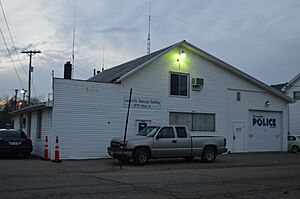
Village hall
|
|

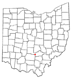
Location of Laurelville, Ohio
|
|

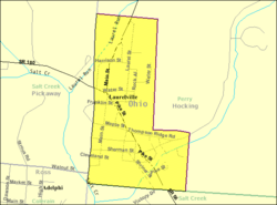
Detailed map of Laurelville
|
|
| Country | United States |
| State | Ohio |
| County | Hocking |
| Area | |
| • Total | 0.21 sq mi (0.55 km2) |
| • Land | 0.21 sq mi (0.55 km2) |
| • Water | 0.00 sq mi (0.01 km2) |
| Elevation | 748 ft (228 m) |
| Population
(2020)
|
|
| • Total | 512 |
| • Density | 2,426.54/sq mi (936.74/km2) |
| Time zone | UTC-5 (Eastern (EST)) |
| • Summer (DST) | UTC-4 (EDT) |
| ZIP codes |
43135, 43152
|
| Area code(s) | 740 |
| FIPS code | 39-42084 |
| GNIS feature ID | 2398399 |
Laurelville is a small village located in Hocking County, Ohio, in the United States. In 2020, about 512 people lived there.
The Hocking State Forest is also found close to Laurelville. This forest is a great place for outdoor activities.
Contents
History of Laurelville
Laurelville was first planned out in 1871. Three people named John Albin, W. S. Albin, and Solomon Riegel helped create the village.
The village got its name from the many laurel plants that grew naturally around the area where the town was built.
Geography and Location
Laurelville is a small place. According to the United States Census Bureau, the village covers an area of about 0.21 square miles (0.55 square kilometers). All of this area is land.
Population and People
The number of people living in Laurelville has changed over the years. Here is a quick look at its population:
| Historical population | |||
|---|---|---|---|
| Census | Pop. | %± | |
| 1880 | 165 | — | |
| 1890 | 266 | 61.2% | |
| 1900 | 450 | 69.2% | |
| 1910 | 457 | 1.6% | |
| 1920 | 425 | −7.0% | |
| 1930 | 449 | 5.6% | |
| 1940 | 491 | 9.4% | |
| 1950 | 482 | −1.8% | |
| 1960 | 539 | 11.8% | |
| 1970 | 624 | 15.8% | |
| 1980 | 591 | −5.3% | |
| 1990 | 605 | 2.4% | |
| 2000 | 533 | −11.9% | |
| 2010 | 527 | −1.1% | |
| 2020 | 512 | −2.8% | |
| U.S. Decennial Census | |||
Population in 2010
In 2010, there were 527 people living in Laurelville. These people lived in 252 different homes. The village had about 2,510 people per square mile.
Many types of families lived in Laurelville. About 26% of homes had children under 18. The average age of people in the village was about 39.5 years old.
Education in Laurelville
Laurelville used to have its own elementary school. This school was part of the Logan Elm Local School District.
However, in 2023, the old school building was taken down. This happened because the school district built a new, bigger school. The new school made the old one no longer needed.
Laurelville also has a public library. It is a branch of the Logan-Hocking Public Library. This means local kids and families can visit to read books and learn.
See also
 In Spanish: Laurelville (Ohio) para niños
 | Laphonza Butler |
 | Daisy Bates |
 | Elizabeth Piper Ensley |

