Lazaretto Creek (Little Nottoway River tributary) facts for kids
Quick facts for kids Lazaretto Creek |
|
|---|---|
| Other name(s) | Tributary to the Little Nottoway River |
| Country | United States |
| State | Virginia |
| County | Nottoway |
| Physical characteristics | |
| Main source | by Piedmont State Hospital, about 2 miles northeast of Burkeville, Virginia 490 ft (150 m) 37°11′28″N 078°10′44″W / 37.19111°N 78.17889°W |
| River mouth | Little Nottoway River about 0.5 miles southwest of Nottoway Court House, Virginia 290 ft (88 m) 37°07′55″N 078°05′46″W / 37.13194°N 78.09611°W |
| Length | 8.03 mi (12.92 km) |
| Basin features | |
| Progression | southeast |
| River system | Nottoway River |
| Basin size | 8.89 square miles (23.0 km2) |
| Tributaries |
|
| Waterbodies | Crystal Lake |
| Bridges | US 460 Rocky Ford Road Lone Pine Road The Falls Road Bible Road |
Lazaretto Creek is a small but important waterway in Virginia, United States. It flows for about 8.89 miles (14.31 km) through Nottoway County. This creek is a tributary, which means it's a smaller stream that flows into a larger one. Lazaretto Creek eventually joins the Little Nottoway River.
Contents
Lazaretto Creek: A Virginia Waterway
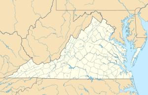
Lazaretto Creek is located in the south-central part of Virginia. It is part of a much larger water system called the Chowan-Albemarle drainage. This system collects water from a wide area and eventually carries it to the Albemarle Sound.
Where Does Lazaretto Creek Start and End?
The creek begins near Piedmont State Hospital. This is about 2 miles northeast of a town called Burkeville, Virginia. From there, it flows generally towards the southeast.
Lazaretto Creek ends when it flows into the Little Nottoway River. This meeting point is about half a mile southwest of Nottoway Court House, Virginia.
What's in a Name?
The name "Lazaretto" might sound a bit unusual. It comes from an old Spanish word that means "prison" or "quarantine hospital." It's interesting how some places get their names!
The Land Around the Creek
The area around Lazaretto Creek is called its watershed. A watershed is all the land where water drains into a particular river or creek. For Lazaretto Creek, its watershed covers about 8.89 square miles (23.0 km²).
- About 51% of the land in this watershed is covered by forests.
- Another 39% is used for farming, which is called agricultural land.
- The rest of the land is used for other purposes, like towns or roads.
Bridges Over the Creek
Several roads cross over Lazaretto Creek. These bridges help people travel easily across the area. Some of the main roads that cross the creek include:
- US 460
- Rocky Ford Road
- Lone Pine Road
- The Falls Road
- Bible Road
 | Jewel Prestage |
 | Ella Baker |
 | Fannie Lou Hamer |


