Limbri, New South Wales facts for kids
Quick facts for kids LimbriNew South Wales |
|
|---|---|

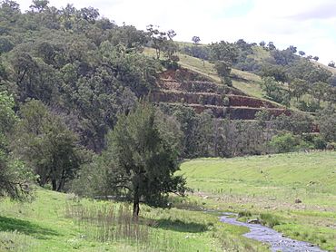
Swamp Oak Creek and the rail cutting at Limbri
|
|
| Population | 259 (2006 census) |
| Postcode(s) | 2352 |
| Elevation | 477 m (1,565 ft) |
| Location | |
| LGA(s) | Tamworth Regional Council |
| County | Inglis |
| State electorate(s) | Tamworth, Northern Tablelands |
| Federal Division(s) | New England |
Limbri is a small village located on Swamp Oak Creek in New South Wales, Australia. It's about 30 kilometers (18 miles) east of Tamworth. In 2006, about 259 people lived in the Limbri area.
Life in Limbri
Limbri is mainly a farming village today. People here raise sheep and cattle. Long ago, some gold was found in the area, but it's not a mining town anymore.
Community Services
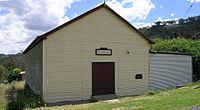
Limbri once had a public school that opened in 1900. It served local families for many years but is now closed. The village also had a general store, which has closed too.
Even though some services have closed, the community is still active. The Limbri Landcare Group helps protect and improve the local environment. The Limbri/Mulla Creek Rural Fire Service is also very important. They are volunteers who help keep the community safe from bushfires.
Limbri's Railway History
Limbri had its own railway station on the Main North railway line. This line connects to places like Armidale. The station first opened in 1885 and was called Farquarsons Siding.
Station Name Change
On December 14, 1893, the station's name was changed to Limbri. The railway station has been closed for several years now. About 300 meters (980 feet) northeast of where the station used to be, you can find the Limbri Tunnel.
| Preceding station | Former Services | Following station | ||
|---|---|---|---|---|
| Danglemah
towards Wallangarra
|
Main North Line | Kootingal
towards Sydney
|
||
 | Georgia Louise Harris Brown |
 | Julian Abele |
 | Norma Merrick Sklarek |
 | William Sidney Pittman |


