
List of Nevada historical markers facts for kids
Nevada historical markers are special signs that help us learn about important places and events in Nevada's history. These markers are like outdoor history lessons, showing you where cool things happened. The program to put up these markers started in 1967. It was created by the Nevada State Legislature to share Nevada's amazing past with everyone. Sadly, due to money problems, the program stopped putting up new markers in 2009.
Contents
Discovering Nevada's History Through Markers
Nevada has many historical markers spread across the state. Each one tells a unique story about a place, a person, or an event. These markers help us understand how Nevada grew and changed over time. They cover everything from old towns and famous people to important battles and natural wonders.
Famous Places and People
Many markers celebrate important locations or individuals. For example, Marker No. 35 tells us about the Las Vegas Mormon Fort and Rancho. This is Nevada's oldest building! It shows us where some of the first settlements were. Another marker, No. 28, is about the famous writer Mark Twain, who spent time in Nevada. Marker No. 143 honors Sarah Winnemucca Hopkins, an important Native American leader and writer.
Mining and Ghost Towns
Nevada is famous for its mining history. Many markers point out old mining towns and areas where people searched for gold and silver.
Gold and Silver Rush Towns
Markers like No. 14, Goldfield, and No. 15, Tonopah, highlight towns that boomed during the gold and silver rushes. These places were once full of life and excitement. Marker No. 90, Delamar, was even called "The Widow Maker" because of its dangerous mining conditions.
Life in Mining Camps
You can also find markers about smaller mining camps. Marker No. 201, Wonder Historic Mining Camp, tells the story of a camp that was active from 1906 to 1919. These markers help us imagine what life was like for miners and their families.
Important Trails and Transportation
Nevada was a key part of many old travel routes. Historical markers show where pioneers, traders, and even camels once traveled.
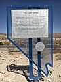
The Old Spanish Trail
Several markers, like No. 31 through 34, and No. 139 through 142, mark parts of the Old Spanish Trail. This was a very long and difficult trade route used from 1829 to 1850. It connected New Mexico to California, passing through southern Nevada.
Unique Ways to Travel
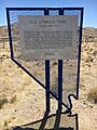
Did you know camels were used in Nevada? Marker No. 104, The Camel Corps, tells us about this unusual part of history. Also, Marker No. 195, The Last Spike, marks where a very important railroad line was completed. This railroad helped connect Nevada to other parts of the country.
Native American Heritage
Markers also share stories about Nevada's Native American people and their history.
Ancient Sites
Marker No. 27, Grimes Point, points to a prehistoric rock art site. This shows us ancient art left by early people. Marker No. 147, A Home of Early Man, also highlights places where early humans lived.
Tribal Communities
You can find markers about specific tribes and their lands. Marker No. 181, The Washo Indians, tells about the Washoe people. Marker No. 146, McDermitt Indian Reservation, is about the Northern Paiute people. These markers help us remember the long history of Native Americans in Nevada.
Unique and Interesting Stories
Some markers tell truly unique stories that might surprise you.
The Great Train Robbery
Marker No. 128, The Great Train Robbery (Nevada), tells about a famous train robbery that happened in Nevada. It's like a real-life adventure story!
The Fight of the Century
Marker No. 220, The Fight of the Century, marks the spot of a huge boxing match. These markers bring exciting moments from the past to life.
Images for kids
-
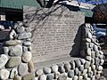
Junction House, Marker No. 4
-
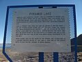
Pyramid Lake, Marker No. 18
-
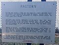
Ragtown, Marker No. 19
-
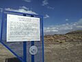
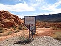
Grimes Point, Marker No. 27
-
Chinese in Nevada, Marker No. 29
-
Reno, Marker No. 30
-
Reno, Marker No. 30 (wide view)
-
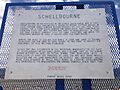
Schellbourne, Marker No. 51 (closeup)
-
Schellbourne, Marker No. 51
-
Stokes Castle, Marker No. 59
-

Truckee River – West, Marker No. 62
-
Truckee River – East, Marker No. 63
-
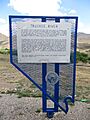
Jarbidge, Marker No. 69
-

Civil War Plot, Marker No. 79
-

Grand Army Of The Republic Memorial Tree, Marker No. 81
-
Sutro, Marker No. 85
-
Sparks, Marker No. 88
-

Round Mountain, Marker No. 96
-
Osceola, Marker No. 98
-
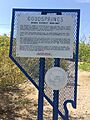
Goodsprings, Marker No. 102
-
Franktown, Marker No. 114
-
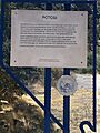
Potosi, Marker No. 115
-
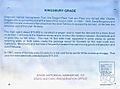
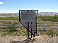
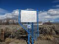
Kingsbury Grade, Marker No. 117
-
Luther Canyon, Marker No. 118
-
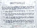
Mottsville, Marker No. 121
-
Double Springs, Marker No. 126
-
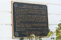
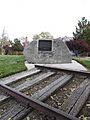
The Great Train Robbery, Marker No. 128
-
Belmont, Marker No. 138
-
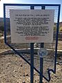
The Old Spanish Trail (Armijo's Route), Marker No. 141
-
The Old Spanish Trail (Mountain Springs Pass), Marker No. 142
-
Unionville, Marker No. 145
-
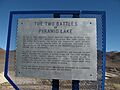
The Two Battles Of Pyramid Lake, Marker No. 148
-
Gerlach, Marker No. 152
-
Camp McGarry, Marker No. 162
-
Chinatown (Dayton), Marker No. 163
-
Bowers Mansion, Marker No. 166
-
Arrowhead Trail, Marker No. 168
-
Glendale School, Marker No. 169
-
Glendale School, Marker No. 169 (wide view)
-
Beatty, Marker No. 173
-
The Surveyors, Marker No. 176
-
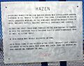
Hazen, Marker No. 178
-
Southern Pacific Railroad Yards, Marker No. 189
-
Buckland's Station, Marker No. 192
-
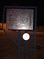
The Last Spike, Marker No. 195
-
Road Marker for Nevada Historical Markers (associated with No. 195)
-
Nevada-California-Oregon Railroad Depot, Marker No. 210
-
Nevada-California-Oregon Railroad Depot, Marker No. 210 (wide view)
-
Old Geiger Grade, Marker No. 211
-
Galena, Marker No. 212
-
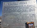
Rafael Rivera, Marker No. 214
-

Geiger Station, Marker No. 218
-
Glenbrook, Marker No. 219
-
The Fight of the Century, Marker No. 220
-
Sand Harbor, Marker No. 221
-

Lake Mansion, Marker No. 227
-
Mount Rose Weather Observatory, Marker No. 230
-
Moana Springs, Marker No. 234
-
Huffaker's, Marker No. 238
-
Coney Island, Marker No. 240
-
Corbett—Fitzsimmons Fight, Marker No. 243
-

Frederick Joseph DeLongchamps, Marker No. 245
-

The Great Incline of the Sierra Nevada, Marker No. 246
-
Site of Nevada's First Public Library, Marker No. 247
-
Virginia & Truckee Railroad Right of Way, Marker No. 248
-
Emigrant—Donner Camp, Marker No. 253
.jpg)
.jpg)


.jpg)
,_Nevada_Historical_Marker_No._63,_Near_Sparks,_Nevada_(18083886531).jpg)

.jpg)


_(2715227645).jpg)


.jpg)


.jpg)
.jpg)


.jpg)
,_Nevada_Historical_Marker_No._168.jpg)


.jpg)


.jpg)
.jpg)

.jpg)

.jpg)


.jpg)

.jpg)


.jpg)
.jpg)
.jpg)

.jpg)
