
List of Pennsylvania state historical markers in Berks County facts for kids

Have you ever seen a special sign by the road or in a town that tells you about something important that happened there? These are called historical markers. They are like outdoor history books! In Berks County, Pennsylvania, there are 66 of these official signs. They are put up by the Pennsylvania Historical and Museum Commission (PHMC) to help us learn about the amazing people, places, and events that shaped Pennsylvania's past.
These markers share stories about early settlers, brave soldiers, important leaders, and even famous artists. They also point out special buildings, old industries, and places where big events took place. Let's explore some of the fascinating history you can discover in Berks County!
Famous People from Berks County
Berks County has been home to many important figures who made a difference in history. Their stories are told on these special markers.
Daniel Boone: Frontier Explorer

One of the most famous people from Berks County is Daniel Boone (1734-1820). He was a legendary American pioneer and explorer. He was born near Baumstown in Berks County. Boone is known for his explorations and for helping to settle the American frontier. He spent much of his life exploring the wilderness, especially in Kentucky. His adventures helped open up new lands for settlers. You can visit the Daniel Boone Homestead in Berks County, which is his birthplace.
Carl A. Spaatz: Air Force General

Carl A. Spaatz (1891-1974) was a highly respected American Air Force general. He was born in Boyertown, Berks County. During World War II, he played a very important role. He commanded the U.S. Army Air Forces in Europe. Later, he led the strategic bombing campaign against Japan. After the war, he became the first Chief of Staff of the United States Air Force. His leadership helped shape modern air power.
Joseph Hiester: Pennsylvania Governor

Joseph Hiester (1752-1832) was a soldier in the American Revolution and later became a governor of Pennsylvania. He was born in Berks County. During the Revolutionary War, he fought bravely and was even captured by the British. After the war, he served in the U.S. Congress. He was elected governor in 1820. His home in Reading is also marked, showing his importance to the area.
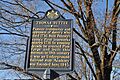
Thomas Mifflin: Revolutionary Leader

Another important governor from Berks County was Thomas Mifflin (1744-1800). He was a major general in the Continental Army during the American Revolution. He also served as the president of the Continental Congress. After the war, he became the first governor of Pennsylvania under its 1790 constitution. His marker highlights his contributions to both the military and government.
Wallace Stevens: Famous Poet

Wallace Stevens (1879-1955) was a famous American poet. He was born in Reading, Berks County. Even though he worked in insurance for most of his life, he became one of the most important American poets of the 20th century. His poetry is known for its deep thoughts and beautiful language. His marker celebrates his literary achievements.
Important Places and Events
Berks County's history isn't just about people; it's also about the places where history happened and the events that changed lives.
Early Settlements and Industries

Many historical markers tell the story of how Berks County was settled. The Swedish Pioneers marker in Douglassville reminds us of the early Swedish families who came to this area. They were among the first European settlers in Pennsylvania.
The Iron industry was very important in Berks County's early days. Places like Hopewell Village and Robesonia Furnace were busy iron-making centers. These furnaces produced iron that was used for tools, cannons, and many other things needed for daily life and for wars. These markers show how important industry was to the region's growth.
The Underground Railroad

The Bethel A.M.E. Church in Reading has a marker that tells about its role in the Underground Railroad. This was a secret network of safe houses and routes. It helped enslaved African Americans escape to freedom in the North before the Civil War. The church was a vital stop on this path to freedom.
Reading Railroad Massacre

The Reading Railroad Massacre marker remembers a sad event that happened in 1877. During a time of economic hardship, railroad workers went on strike. There were clashes between the workers and the state militia. Several people were killed. This event was a significant moment in the history of labor rights in America.
Hawk Mountain Sanctuary
Hawk Mountain Sanctuary is a special place for nature lovers. It's the world's first refuge for birds of prey. The marker here celebrates its importance in protecting hawks, eagles, and falcons. It also highlights the role of women in its founding and conservation efforts.
Duryea Drive: Automotive History

Duryea Drive in Reading is named after Charles and Frank Duryea. They were pioneers in the American automobile industry. In the late 1800s, they built one of the first successful gasoline-powered cars in the United States. The markers on Duryea Drive celebrate their contributions to transportation and invention.
Images for kids
-
Anthony Sadowski marker image.
-

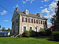
Baird House marker image.
-
Ben Austrian marker image.
-
Berks County Courthouse.
-
Charming Forge marker image.
-
Christ Little Tulpehocken Church marker image.
-
Colebrookdale Furnace marker image.
-
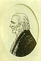
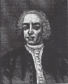
Conrad Weiser portrait.
-
Conrad Weiser Trading Post marker image.
-
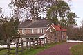
Daniel Boone's Birthplace.
-
De Benneville House marker image.
-
De Turk House marker image.
-
Doctor Jonathan Potts marker image.
-
Dr. Bodo Otto portrait.
-
Duryea Drive marker image.
-
Eight-Cornered School marker image.
-
Federal Inn marker image.
-
Fisher House in Oley Township.
-
Fort Henry marker image.
-
Goshenhoppen marker image.
-
Henry A. Muhlenberg marker image.
-
Hereford Furnace marker image.
-
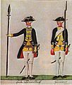
Hessian Jäger, representing Hessian Camp.
-
Hiester Home marker image.
-
Hopewell Village marker image.
-
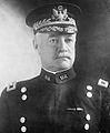
Hunter Liggett portrait.
-
James Maurer.
-
Jeremiah Sweinhart and Successors marker image.
-
John A. Shulze portrait.
-
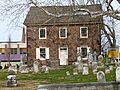
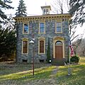
Mordecai Lincoln House.
-
Northkill Amish marker image.
-
Oley Moravians marker image.
-
Penn's Common marker image.
-
Pilger Ruh marker image.
-
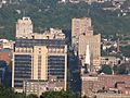
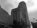
Reading, Pennsylvania skyline.
-
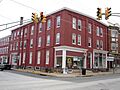
Boyertown Opera House Building.
-
Robesonia Furnace.
-
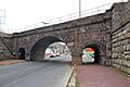
Skew Arch Bridge.
-
Solomon Boscov marker image.
-
Thomas Rutter portrait.
-
Thompson's Rifle Battalion marker image.
-
Tulpehocken Path marker image.
-
Union Canal marker image.
-
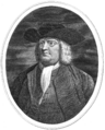
William Penn portrait.
-
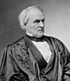
William Strong portrait.

.jpg)


See also
- List of Pennsylvania state historical markers
- National Register of Historic Places listings in Berks County, Pennsylvania
