List of Pennsylvania state historical markers in Elk County facts for kids
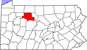
Have you ever seen a special sign by the road or in a town that tells you about something important that happened there? These are called historical markers! This article is about the official state historical markers found in Elk County, Pennsylvania. These markers are placed by the Pennsylvania Historical and Museum Commission (PHMC). The PHMC is a group that helps protect and share Pennsylvania's history.
There are four historical markers in Elk County. They tell us about different parts of the area's past. Let's explore them!
Discovering Elk County's History Through Markers
Historical markers are like outdoor history books. They help us learn about important places, people, or events. In Elk County, these markers share stories about the land, government, and early settlers.
Elk County Marker
This marker celebrates Elk County itself! It was put up on July 22, 1982. You can find it in Ridgway, which is the main town of Elk County. It's located near the County Courthouse on South Main Street. This marker helps us remember how the county was formed and its role in Pennsylvania's government. It also touches on the environment of the area.
- Location: County Courthouse, South Main Street, Ridgway
- Coordinates: 41.421794, -78.729916 (These numbers help pinpoint the exact spot on a map!)
- Type: City marker
- Topics: Environment, Government & Politics (especially from the 1800s)
First State Game Lands Marker
This marker tells us about a big step in protecting nature! It was dedicated on October 20, 1950. It marks the location of the very first State Game Lands in Pennsylvania. These lands are special areas set aside for wildlife and outdoor activities like hunting and fishing. You can find this marker on Glen Hazel Road, south of Bendigo Road, near Wilcox. It shows how important it was to protect the environment in the 1900s.
- Location: Glen Hazel Road, south of Bendigo Road, Wilcox
- Coordinates: 41.5345, -78.60728
- Type: Roadside marker
- Topics: Environment, Government & Politics (especially from the 1900s)
Iroquois "Main Road" Marker
This marker, placed on October 7, 1950, tells us about an old path used by Native Americans. It's about the "Main Road" of the Iroquois people. This road was an important travel route long ago. It also reminds us of the French & Indian War and the role Native Americans played in the history of this region. This marker is located near Johnsonburg, at the intersection of PA 66 and 948 in Highland Township.
- Location: PA 66 & 948, Highland Township, Johnsonburg (Note: This marker might be missing today.)
- Type: Roadside marker
- Topics: African American history, French & Indian War, Military history, Native American history
St. Marys Marker
This marker celebrates the town of St. Marys. St. Marys is known for its unique history, especially related to different groups of people who settled there and their religious beliefs. You can find this marker in St. Marys, near the Diamond, where St. Mary's Street (PA 255) and State Street (PA 120) meet.
- Location: St. Mary's Street (PA 255) & State Street (PA 120) near the Diamond, St. Marys
- Coordinates: 41.42838, -78.56133
- Type: Roadside marker
- Topics: Cities & Towns, Ethnic & Immigration history, Religion
See also
- List of Pennsylvania state historical markers
- National Register of Historic Places listings in Elk County, Pennsylvania
 | Isaac Myers |
 | D. Hamilton Jackson |
 | A. Philip Randolph |


