List of Pennsylvania state historical markers in Union County facts for kids
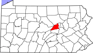
This page lists the Pennsylvania state historical markers in Union County. These markers are like special signs that tell us about important places, people, or events in history. They are placed by the Pennsylvania Historical and Museum Commission (PHMC).
You can find 22 historical markers across Union County, Pennsylvania. Each marker helps us learn more about the past of this area. They cover many different topics, from early settlers and Native American history to important battles and famous people.
Historical Markers in Union County
Bucknell University
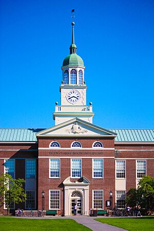
Bucknell University is a well-known school in Lewisburg. It was founded in 1846. The university has a rich history in education and religion. It has also played a role in the history of women's education. The marker for Bucknell University was placed on September 22, 1947. You can find it on U.S. Route 15 in Lewisburg, near the stadium.
Buffalo Church
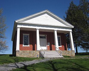
The Buffalo Church is an important historical site. It is located west of Lewisburg. This church has ties to early Native American history and the first settlers in the area. There are two markers for Buffalo Church, both dedicated on June 9, 1948. One is on Pa. Route 192, and the other is on Pa. Route 45.
Colonel John Kelly
Col. John Kelly was an important figure in the American Revolution. He was a military leader during this time. His marker tells us about his role in the fight for independence. It also touches on early settlement and Native American interactions. This marker was dedicated on March 21, 1952. You can find it on SR 1002, east of Mazeppa.
Dry Run Cemetery
Dry Run Cemetery is a historic burial ground. It is important for understanding the early settlement of the area. The cemetery also has connections to the French and Indian War and military history. It shows the role of religion in the lives of early settlers. The marker was placed on June 9, 1948, on Pa. Route 304, west of New Berlin.
Eli Slifer
Eli Slifer was a key person during the Civil War. He was involved in government and politics during the 19th century. His work helped shape the state and national government during a difficult time. The marker for Eli Slifer was dedicated on October 4, 1968. It is located on U.S. Route 15, north of Lewisburg.
Evangelical Church
The Evangelical Church played a big part in the religious history of Union County. It was a significant religious movement. There are two markers for the Evangelical Church, both dedicated on September 22, 1947. One is on Pa. Route 304, west of New Berlin. The other is in Mifflinburg, at the junction of Pa. Route 45 and 104.
Fought's Mill
Fought's Mill was an important mill in Mifflinburg. Mills were vital for early communities, grinding grain into flour. This site is connected to the American Revolution and early business and industry. It also shows how government and politics worked in the 18th century. The marker was dedicated on September 22, 1947. It is on Pa. Route 45 in Mifflinburg.
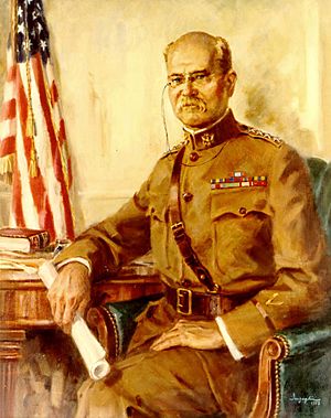
General Tasker H. Bliss
General Tasker H. Bliss was a notable military leader. He served in the military after the Civil War. His marker highlights his contributions to the armed forces. It was dedicated on November 22, 1954. You can find it on South Front Street in Lewisburg.
Lee Massacre
The Lee Massacre was a tragic event involving Native Americans and settlers. It happened during the American Revolution. This marker reminds us of the conflicts that occurred during that period. It was dedicated on April 28, 1947. The marker is on U.S. Route 15 in Winfield.
Leroy Massacre
The Leroy Massacre was another significant event in the area's history. It took place during the French and Indian War. This event involved military actions and Native American interactions. There are two markers for the Leroy Massacre. One was dedicated on April 28, 1947, on Pa. Route 104 south of Mifflinburg. The other is a plaque dedicated on July 19, 1919, on Ridge Road.
Lewisburg Cross-Cut Canal
The Lewisburg Cross-Cut Canal was an important part of transportation history. Canals were like water highways that helped move goods and people. This marker tells us about the role of canals in navigation and trade. It was dedicated on January 3, 1955. You can find it on Pa. Route 45 (Market Street) in Lewisburg.
Ludwig Derr
Ludwig Derr was a key figure in the founding of Lewisburg. He was involved in government and politics. He also operated mills, which were important businesses at the time. His marker highlights his contributions to the community. It was dedicated on November 22, 1954, on Brown Street in Lewisburg.
Robert Lowry
Robert Lowry was a famous hymn writer. He was known for his music and religious works. His marker celebrates his contributions to music and religion. It was dedicated on November 22, 1954. You can find it on University Avenue in Lewisburg.
Samuel Maclay
Samuel Maclay was involved in government and politics during the 18th century. He played a role in the early political landscape of Pennsylvania. His marker was dedicated on April 28, 1947. It is located on Pa. Route 45, southwest of Lewisburg.
Shikellamy's Old Town
Shikellamy's Old Town was an important Native American settlement. It shows the early history of cities and towns in the area. This site is significant for understanding early settlement and Native American government. There are two markers for Shikellamy's Town. One is a plaque dedicated on August 1, 1921, at Central Oak Heights. The other was dedicated on April 28, 1947, on U.S. Route 15 north of Lewisburg.
Underground Railroad
The Underground Railroad was a secret network. It helped enslaved African Americans find freedom before the Civil War. This marker highlights the role of Union County in this important movement. It was dedicated on November 22, 1954. You can find it on University Avenue in Lewisburg.
Union County
Union County itself has a historical marker. It tells about the county's government and political history, especially in the 19th century. This marker was dedicated on May 10, 1982. It is located at the County Courthouse in Lewisburg.
Widow Catherine Smith
Widow Catherine Smith was an important woman in local business and industry. Her marker tells us about her contributions. It was dedicated on May 25, 1967. You can find it on SR 1011 in White Deer.
Images for kids
See also
- List of Pennsylvania state historical markers
- National Register of Historic Places listings in Union County, Pennsylvania
 | Claudette Colvin |
 | Myrlie Evers-Williams |
 | Alberta Odell Jones |


