List of ghost towns in Franklin County, Ohio facts for kids
A ghost town is a place that used to be a town or city but is now mostly empty. People might have left because a mine closed, a railroad moved, or a natural disaster happened. In Franklin County, Ohio, there are several places that were once busy towns but are now just memories or small areas with a few buildings. This list tells you about some of these interesting ghost towns.
Contents
- Evanston: A Town with Two Names
- Five Mile Siding: A Railroad Stop
- Hibernia: Where Only a Cemetery Remains
- Olentangy Station: Another Railroad Town
- Park's Mill: A Short-Lived Post Office
- Pinhook: By the Creek and Crossroads
- Seagrove: A Historic Neighborhood Now Warehouses
- Shattucksburg: From Plots to Industrial Buildings
- Sullivant: Named After a Founder
- Thomas Lane Neighborhood: A Family's Home
- Wonderland: Bought Out by the Airport
- See also
Evanston: A Town with Two Names
Evanston was a small town located near North Broadway and the railroad tracks. Because of its location, it was also known as North Broadway. It was close to the area we now call Clintonville, Columbus, Ohio.
Five Mile Siding: A Railroad Stop
Five Mile Siding was a small town that grew up around a railroad stop. It was located near the border between Blendon Township and Mifflin Township. Railroads were very important for towns in the past!
Hibernia: Where Only a Cemetery Remains
Hibernia was a town that sat along the Big Walnut Creek. Today, you won't find the town itself. All that's left is its old cemetery. There's also an apartment complex nearby that carries the name Hibernia, keeping its memory alive.
Olentangy Station: Another Railroad Town
Olentangy Station was a town located along the Hocking Valley Railroad. This town was in Clinton Township. Like many towns, its life was tied to the railroad.
Park's Mill: A Short-Lived Post Office
Park's Mill was a town in Mifflin Township. You would find it around where Sunbury Road and McCutcheon Road are today. It even had its own post office for a short time, from 1851 to 1853.
Pinhook: By the Creek and Crossroads
Pinhook was a town located at an important intersection. This was where Dublin-Granville Road met Columbus-Central College Pike, which is now known as Sunbury Road. It was in Blendon Township, right next to Big Walnut Creek.
Seagrove: A Historic Neighborhood Now Warehouses
Seagrove is a historic area of Columbus, Ohio, that used to be a busy neighborhood. It existed before 1872 in what was then southern Clinton Township. You would find it at Lisle Avenue (now Kenny Road) and Lane Avenue. Today, this area is mostly filled with warehouses. A few buildings from before 1962 still stand. Seagrove was also known by other names like Lanevue and Lane Avenue.
Shattucksburg: From Plots to Industrial Buildings
Shattucksburg began when Simon Shattuck sold off parts of his land. The town lasted for many years before it slowly disappeared in the 1970s.
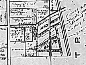
Shattucksburg was founded sometime before 1856. It was located along what was then Henderson Road, which is now DeSantis Court and Old Henderson Road, where it met Kenny Road. The town wasn't originally planned to be a big town. However, when the railroad came through in the mid-1800s, it started to grow. Between 1910 and 1927, Shattucksburg had six streets, not counting Henderson Road. These streets were Mobile Drive, Midwest Drive, Inglewood Avenue, Winton Road, Lincoln Road, and Edgewood Drive.
The town started to vanish from maps in the 1970s. One of the last maps to show the whole town was the 1960 Census Tract Map of Franklin County. By 1974, most of the town had disappeared from maps, except for Winton Road and Mobile Drive. As of 2016, the last original roads that still exist are Mobile Drive, Old Henderson Road (which was Henderson Road), and Midwest Drive. There's also a property line that marks where Winton Road used to be. Today, the land where Shattucksburg once stood is mostly industrial buildings. These include places like Evans Adhesive, Dale Cleaners, and a train museum called The Depot. Sometimes, the area is mistakenly called Midwest Boulevard, even though there is only a Midwest Drive.
Sullivant: Named After a Founder
Sullivant was a town that was named after Lucas Sullivant. He was an important person in the early history of this area.
Thomas Lane Neighborhood: A Family's Home
This neighborhood was mainly home to the Bacon family. It was built along a small road called Thomas Lane. The area was mapped out between 1872 and 1910. Thomas Lane still exists today, but it no longer crosses the railroad tracks. The area has also become more suburban, with many modern homes.
Wonderland: Bought Out by the Airport
Wonderland was a town located at Hamilton Road and I-270. This town was eventually bought out by the airport. This often happens when airports need more space to grow.
See also
- List of ghost towns in Ohio
- Neighborhoods in Columbus, Ohio


