
List of highways in Essex County, New York facts for kids

Standard route marker for county routes in Essex County
|
|

Map of Essex County's highway system
|
|
Quick facts for kids Highway names |
|
|---|---|
| Interstates: | Interstate X (I-X) |
| US Routes: | U.S. Route X (US X) |
| County: | County Route X (CR X) |
| System links | |
| Numbered highways in New York Interstate • U.S. • N.Y. (former) • Reference • County |
|
Essex County in New York has a big network of roads! It includes over 1,300 miles of highways. These roads are taken care of by different groups: the New York State Department of Transportation (which handles state roads), the county itself, and the local towns and villages.
About 18 state highways run through Essex County. These make up about 329 miles of roads. On top of that, the county maintains about 356 miles of its own roads. Many of these county roads help connect the bigger state highways. Some roads in the county also lead to ferry docks and bridges that cross Lake Champlain.
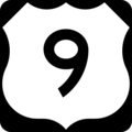
Essex County has one major Interstate Highway, called I-87. People often call it the Adirondack Northway. There's also one United States Numbered Highway, US 9. This road runs very close to I-87 as they both go north and south through the county.
Besides these, Essex County has 11 state touring routes. These are the main state roads you'd use for travel. There are also six "reference routes," which are shorter, unmarked roads that connect other highways. The longest state touring route in Essex County is NY 9N, which is about 67 miles long. The shortest is NY 373, at just over 3 miles.
Contents
Major Highways in Essex County
Interstate and US Routes
Essex County is home to I-87, a major highway that stretches for about 57 miles. It runs from the border with Warren County all the way up to the Clinton County line. This highway was built in 1967. It runs next to US 9.
.jpg)
US 9 is the only U.S. Route in Essex County. It covers about 59 miles. This road was first created in 1926. It followed an old stagecoach route and hasn't changed much since then.
State Touring Routes
There are 10 main state touring routes in Essex County. The longest is NY 9N, which is about 67 miles long. It goes from the Warren County line to the Clinton County line. The shortest is NY 373, at about 3 miles.

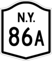
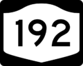
Some state highways that used to be in Essex County have changed or been removed. For example, NY 192 is now part of NY 86. Also, NY 427 and NY 86A are now part of NY 73. Other roads, like NY 8, still exist but no longer pass through Essex County.
County Routes
Essex County has more than 60 county routes. You can spot them by their special five-sided (pentagonal) signs, which are yellow on blue. These signs are used for county highways in most of New York State.
The first county route in the list is CR 2, also known as Corduroy Road. The last one is CR 86E, called Saint Huberts Road. In the town of Keene, there are five county routes along NY 73. These roads used to be part of an older highway called NY 86A.
Images for kids
-
County Route 2 sign
-
County Route 3 sign
-
County Route 4 sign
-
County Route 5 sign
-
County Route 6 sign
-
County Route 6A sign
-
County Route 7 sign
-
County Route 7B sign
-
County Route 8 sign
-
County Route 10 sign
-
County Route 10A sign
-
County Route 11 sign
-
County Route 12 sign
-
County Route 13 sign
-
County Route 14 sign
-
County Route 15 sign
-
County Route 16 sign
-
County Route 17 sign
-
County Route 18 sign
-
County Route 19 sign
-
County Route 20 sign
-
County Route 21 sign
-
County Route 23 sign
-
County Route 24 sign
-
County Route 25 sign
-
County Route 26 sign
-
County Route 26A sign
-
County Route 27 sign
-
County Route 28 sign
-
County Route 29 sign
-
County Route 29A sign
-
County Route 30 sign
-
County Route 31 sign
-
County Route 32 sign
-
County Route 33 sign
-
County Route 34 sign
-
County Route 35 sign
-
County Route 36 sign
-
County Route 37 sign
-
County Route 38 sign
-
County Route 39 sign
-
County Route 40 sign
-
County Route 41 sign
-
County Route 42 sign
-
County Route 43 sign
-
County Route 44 sign
-

County Route 45 sign
-
County Route 46 sign
-

County Route 47 sign
-
County Route 48 sign
-

County Route 49 sign
-
County Route 50 sign
-
County Route 51 sign
-

County Route 52 sign
-
County Route 53 sign
-
County Route 54 sign
-
County Route 55 sign
-
County Route 56 sign
-

County Route 57 sign
-
County Route 58 sign
-
County Route 59 sign
-
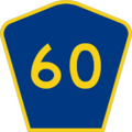
County Route 60 sign
-
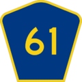
County Route 61 sign
-

County Route 62 sign
-
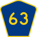
County Route 63 sign
-
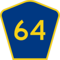
County Route 64 sign
-
County Route 65 sign
-
County Route 66 sign
-
County Route 67 sign
-
County Route 68 sign
-

County Route 69 sign
-
County Route 70 sign
-
County Route 71 sign
-
County Route 72 sign
-
County Route 75 sign
-
County Route 76 sign
-
County Route 77 sign
-
County Route 78 sign
-
County Route 79 sign
-
County Route 80 sign
-
County Route 81 sign
-

County Route 82 sign
-
County Route 83 sign
-
County Route 84 sign
-
County Route 85 sign
-
County Route 86A sign
-
County Route 86B sign
-
County Route 86C sign
-
County Route 86D sign
-
County Route 86E sign
-
County Route 88 sign
-
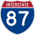
Interstate 87 shield
-
New York State Route 3 shield
-
New York State Route 8 shield
-
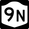
New York State Route 9N shield
-
New York State Route 22 shield
-
New York State Route 28N shield
-
New York State Route 73 shield
-
New York State Route 74 shield
-
New York State Route 86 shield
-
New York State Route 86A shield (1948)
-
New York State Route 185 shield
-
New York State Route 192 shield
-
New York State Route 195 shield (1927)
-
New York State Route 347 shield (1927)
-
New York State Route 347 shield (1948)
-
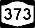
New York State Route 373 shield
-

New York State Route 427 shield (1927)
-
New York State Route 431 shield
-
U.S. Route 9 shield


.svg)


.svg)
.svg)
.svg)

.svg)


