List of historic places in Northern Region, Manitoba facts for kids
Historic places are like special landmarks that tell us stories about the past. They could be old buildings, forts, or even places where important events happened. The Northern Region, Manitoba has many of these cool spots. They are protected because they help us learn about Canada's history.
These places are listed on the Canadian Register of Historic Places. This means they are recognized as important, whether by the federal government, the province of Manitoba, or local towns. Let's explore some of them!
Contents
- Historic Places in Northern Manitoba
- Cool Historic Spots
- York Factory Depot
- Churchill Airport Terminal
- Lynn Lake Bank Building
- York Factory National Historic Site
- Churchill Railway Station
- Prince of Wales Fort
- Sea Horse Gully Remains
- Flin Flon Museum
- Norway House National Historic Site
- Churchill Rocket Research Range
- St. Paul's Anglican Church
- Norway House Archway Warehouse
- Cranberry Portage Railway Station
- Crane River Church Site
- Gillam Railway Station
- The Pas Bank of Commerce
- Christ Church in The Pas
- The Pas Court House
- Charlebois Chapel in The Pas
- Heritage North Museum
- Wanipigow Lake Archaeological Site
- Cool Historic Spots
- See also
Historic Places in Northern Manitoba
Cool Historic Spots
York Factory Depot
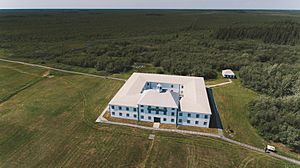
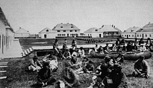
The Depot at York Factory is a very old building. It was part of a major fur trading post. Imagine a time when people traded animal furs for goods! This place was a busy hub for that.
Churchill Airport Terminal
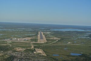
The Air Terminal Building H-7 is at the Churchill Airport. This building has seen many planes come and go. It's a key part of travel in the North.
Lynn Lake Bank Building
In Lynn Lake, you can find the Canadian Imperial Bank of Commerce Building. This old bank building shows how towns grew in the North. It was once a busy place for money and business.
York Factory National Historic Site
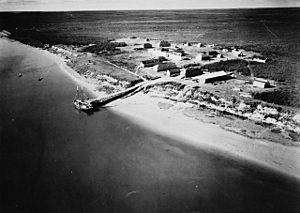
The York Factory National Historic Site of Canada is a huge area. It was one of the most important fur trading posts in North America. The Hudson's Bay Company used it for over 270 years! It's a great place to learn about Canada's early history.
Churchill Railway Station
The Via Rail - Canadian National Railway Station in Churchill is a busy train station. It's located at 1st Street & Railway Avenue. This station connects Churchill to the rest of Canada by rail. It's often called the "Polar Bear Capital of the World" and this station is a gateway for visitors.
Prince of Wales Fort
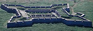
The Prince of Wales Fort National Historic Site of Canada is near Churchill. It's a massive stone fort built by the Hudson's Bay Company. It was meant to protect their fur trade interests. You can still see its strong walls today.
Sea Horse Gully Remains
The Sea Horse Gully Remains National Historic Site of Canada is an archaeological site. It's on the west side of the Churchill River. This site holds clues about ancient peoples who lived here long ago.
Flin Flon Museum
The Flin Flon Museum in Flin Flon is a great place to visit. Museums help us understand the past. This one tells the story of the Flin Flon area and its people.
Norway House National Historic Site
The Norway House National Historic Site of Canada is another important fur trade post. It's located in Norway House. This site played a big role in the fur trade network. It was a meeting point for traders and Indigenous peoples.
Churchill Rocket Research Range
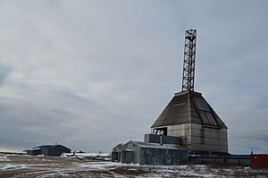
The Churchill Rocket Research Range National Historic Site of Canada is a unique spot. It's where rockets were launched for scientific research. This site helped Canada learn more about space and the atmosphere. It's a cool reminder of Canada's contributions to science.
St. Paul's Anglican Church
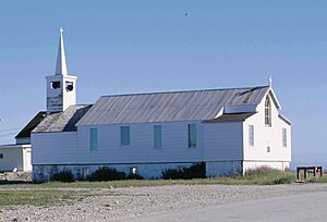
St. Paul's Anglican Church is located at 67 Bernier Street in Churchill. This church has been a place of worship for many years. It's an important part of the community's history.
Norway House Archway Warehouse
The Archway Warehouse, Jail and Powder Magazine Remains are in Norway House. These old buildings were part of the historic trading post. They show how goods were stored and protected in the past.
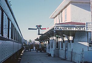
Cranberry Portage Railway Station
The VIA Rail/Canadian National Railways Station in Cranberry Portage is on Railway Avenue. Train stations are important landmarks. They connect communities and have seen many travelers over the years.
Crane River Church Site
The Crane River Reserve Catholic Church Site is in Crane River. This site marks where a church once stood. It's a reminder of the spiritual history of the area.
Gillam Railway Station
Another VIA Rail/Canadian National Railways Station is in Gillam. It's located at 252 Railway Avenue. Like other stations, it's a key part of the town's history and transportation.
The Pas Bank of Commerce
The Bank of Commerce Building at 162 Fischer Avenue in The Pas (also known as Kelsey) is a historic bank. It shows the growth of business in this northern town.
Christ Church in The Pas
Christ Church is at 2 Saskatchewan Crescent in The Pas. This church is a significant part of the town's heritage. It has served the community for many years.
The Pas Court House
The Court House and Community Building is at 306 Fischer Avenue in The Pas. This building has been important for law and community gatherings.
Charlebois Chapel in The Pas
The Charlebois Chapel is at 108 First Street West in The Pas. Chapels are small places of worship. This one holds special meaning for the local history.
Heritage North Museum
The Heritage North Museum in Thompson is at 162 Princeton Drive. This museum helps people learn about the history and culture of the Thompson area. Museums are great places to explore the past.
Wanipigow Lake Archaeological Site
The Wanipigow Lake Archaeological Site is in Division No. 19. This site is important for understanding ancient human activity. Archaeologists study such sites to learn about how people lived thousands of years ago.
See also
 | William L. Dawson |
 | W. E. B. Du Bois |
 | Harry Belafonte |


