
List of local nature reserves in Hertfordshire facts for kids

Hertfordshire is a county in eastern England, just north of Greater London. Its county town is Hertford. In 2014, about 1.15 million people lived here, covering an area of about 1,642 square kilometres (634 square miles).
Hertfordshire is home to many special places called Local Nature Reserves (LNRs). These are areas that local councils protect because they have important plants, animals, or interesting geology. Councils manage these sites to keep them healthy and safe for nature. They can even make special rules to protect them.
As of 2015, Hertfordshire had 42 LNRs. The biggest is Therfield Heath, which is huge at 147.3 hectares (364 acres). It has some of England's best chalk grassland and is also a Site of Special Scientific Interest (SSSI), meaning it's very important for nature. The smallest LNR is Oxleys Wood in Hatfield, only 1.2 hectares (3 acres). This wood often floods, creating a great home for many insects and birds. Some other LNRs, like Croxley Common Moor and Sherrardspark Wood, are also SSSIs. The oldest LNR in Hertfordshire is Hilfield Park Reservoir, protected since 1969, and the newest is Weston Hills, added in 2012.
Explore Hertfordshire's Nature Reserves
Here are some of the amazing Local Nature Reserves you can find in Hertfordshire:
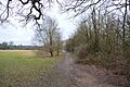
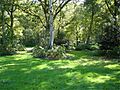
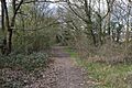
- Albans Wood (4.1 hectares): This is an old, natural woodland with oak, beech, and sweet chestnut trees. You might spot muntjac deer and noctule bats here.
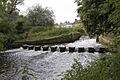
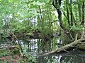
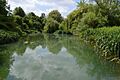
- Batford Springs (3.5 hectares): This reserve is famous for its small springs that create chalk streams and ponds. The River Lea flows through it, and there's also grassland and a small wood.
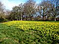
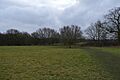
- Cassiobury Park (25.1 hectares): A large park in Watford with streams, ponds, and wet grasslands. The Grand Union Canal and River Gade also run through it.
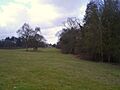
- Cheshunt Park (40.0 hectares): This park has a long history, going back to Roman times! It features grasslands, woodlands, old hedgerows, wildflower meadows, a pond, and an orchard with traditional cattle breeds.
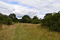
- Chorleywood Common (75.6 hectares): This common has many different habitats, including heathland, grasslands, and woodlands. Over 300 types of fungi, 70 plant species, and 50 bird species have been found here. It's part of the Chilterns Area of Outstanding Natural Beauty (AONB).
- Chorleywood House Estate (64.3 hectares): The River Chess flows through this estate, which has beautiful parkland around an old manor house, meadows, and mature woodlands.
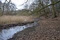
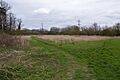
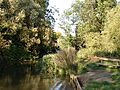
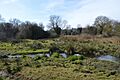
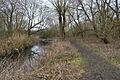
- Colney Heath (22.5 hectares): This site has unusual acid grassland for Hertfordshire, with the River Colne running through it. It's managed to keep the grassland healthy and full of different plant species.
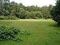
- The Commons (13.2 hectares): Here you'll find oak woodland, meadows full of flowers, wet fens, ditches, and ponds. Livestock often graze in the meadows.
- Croxley Common Moor (41.2 hectares): Mostly grass heathland with some ancient woodland. More than 250 plant species have been recorded here, and it's an SSSI.
- Danesbury Park (24.5 hectares): Once a park for Danesbury House, it still has large, old trees important for wildlife. Its grasslands, grazed by rare-breed cattle, are home to many flowering plants.
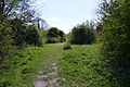
- Fisher's Field (1.8 hectares): This area used to be allotments during World War II. It has woodlands with oak and wild cherry trees, a wildflower meadow, and scrub. You might see green woodpeckers, shrews, and bees.
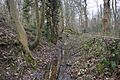
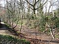
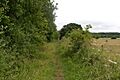
- Furzefield Wood and Lower Halfpenny (7.4 hectares): This wood has been managed for coppicing (cutting trees to encourage new growth) for over 300 years. It's a great home for birds, and fallen branches help invertebrates. Lower Halfpenny is a meadow that was once an old drovers' track.
- Garston Park (6.4 hectares): This reserve has woodlands of oak, ash, and sycamore, plus grasslands and wetlands. Look out for muntjac deer and pipistrelle bats.
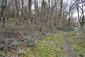
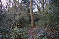
- Harebreaks Wood (5.1 hectares): An old, natural woodland dating back to at least 1600, with oak, ash, and cherry trees. Birds like treecreepers and nuthatches live here, along with muntjac deer and pipistrelle bats.
- Hilfield Park Reservoir (74.7 hectares): This large reservoir is super important for birds like pochards, tufted ducks, and common terns. Its marshy edges are home to many breeding birds and marsh plants. It's managed by the Herts and Middlesex Wildlife Trust (HMWT).
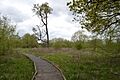
- Howe Dell (4.0 hectares): A woodland site along a stream with steep sides. The main trees are hornbeam, oak, and beech.
- Howe Grove Wood (8.5 hectares): A dense woodland next to the A4147 road in Hemel Hempstead.
- Ivel Springs (15.4 hectares): This site, which was a rubbish dump until the 1950s, now has woodlands, wetlands, and pastures. Its springs are the source of the River Ivel and are full of wildlife.
- The Lairage Land (4.4 hectares): Mostly rough grassland with some woodland. The River Colne runs along its southern edge, with plants like stream water crowfoot and yellow water lily. You might also find Roesel's bush-crickets here.
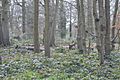
- Mardley Heath (41.1 hectares): This heath was used for gravel mining in the mid-1900s but is now growing back naturally. Oak and hornbeam woodlands remain around the edges and are managed to help nature thrive.
- Marshalls Heath (4.0 hectares): This site has woodlands and scrub on acid heathland. It's a key spot in Hertfordshire for butterflies and moths, with many species, including 40 on national lists of threatened species.
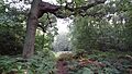
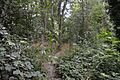
- Northaw Great Wood Country Park (120.7 hectares): One of the county's largest areas of ancient hornbeam woodland, with oak and silver birch trees. Glades, streams, and springs make it very diverse. It's also an SSSI.
- Norton Common (25.7 hectares): This woodland has diverse wildlife, including black squirrels, muntjac deer, and birds like chiff chaffs and blackcaps. There are also wildflower meadows and the Pix Brook, fed by mineral-rich springs.
- Oughtonhead Common (17.4 hectares): Part of the Chilterns AONB, this common has many different habitats. The River Oughton flows along its edge, and English Longhorn cattle graze the pasture areas.
- Oxhey Woods (100.2 hectares): Mostly natural woodland, with some areas dating back 11,500 years to the end of the last Ice Age! You can find bluebells, anemones, violets, and the rare wild service tree here.
- Oxleys Wood (1.2 hectares): This small wood often floods, especially the northern part with a pond. Oak, ash, elm, and willow trees provide a home for insects, which birds then eat.
- Prestwick Road Meadows (2.8 hectares): Formerly farm meadows, this site has many insects and flowers like purple knapweed and red clover. Old hedgerows and a seasonal pond where frogs breed can also be found.
- Purwell Meadows (8.6 hectares): The River Purwell runs through these meadows. You might see kingfishers and water voles here.
- Rickmansworth Aquadrome (41.0 hectares): This site has two lakes and many different wildlife habitats. Look for oaks and willows, birds like herons and moorhens, and butterflies such as small coppers and gatekeepers.
- Sherrardspark Wood (73.2 hectares): Much of this site is sessile oak woodland, with some trees over 250 years old. It has rare flowers like violet and broad-leaved helleborine. It's an SSSI.
- Shrubhill Common (9.8 hectares): This common has woodlands, scrub, and two fields of chalk grassland. There are over 100 types of wildflowers and herbs like marjoram and basil. It's part of the Chilterns AONB.
- Singlers Marsh (6.3 hectares): The River Mimram runs along the edge of this site. It has grasslands, managed by cattle grazing, and willow scrub with some older trees.
- Stanborough Reedmarsh (3.3 hectares): This is a wet willow woodland along the River Lea. It's important for water voles and birds like reed and sedge warblers. Plants like Water figwort and common meadow rue grow along the river bank. It's managed by the HMWT.
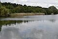
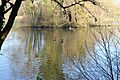
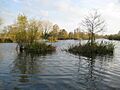
- Stocker's Lake (37.9 hectares): An old flooded gravel pit with over 60 species of breeding birds, including nationally important numbers of shoveler and goldeneye ducks. It's managed by the HMWT.
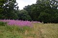
- Therfield Heath (147.3 hectares): This is a very important pasture with some of England's richest chalk grassland. You can find rare plants like the pasque flower and insects such as the chalkhill blue butterfly. It's an SSSI.
- Top Field and Cozens Grove (6.1 hectares): Top Field is a wildflower meadow mowed to help small mammals, birds, and insects. Cozens Grove is an ancient wood with coppiced hornbeam and an old medieval ditch.
- Watercress Wildlife Site (1.2 hectares): This site used to be a commercial watercress farm. It now has a wide variety of wildlife, including water rails, kingfishers, little grebes, and muntjac deer.
- Waterford Heath (35.2 hectares): Mostly grassland with areas of scrub and woodland. Breeding birds include skylarks and willow warblers, and you might see reptiles like slow worms and grass snakes. It's managed by the HMWT.
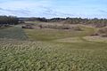
- Weston Hills (17.0 hectares): Its most important feature is its chalk grassland, one of the best examples in Hertfordshire. The tough conditions here mean many different plants can grow without one taking over.
- Wheathampstead (5.9 hectares): This L-shaped site has ash woodland, thorn scrub, old hedgerows, and rough grassland. You can find plants like grass vetchling and bee orchid, birds like yellowhammer and whitethroat, and many butterflies.
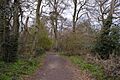
- The Wick (3.4 hectares): An ancient, natural woodland with oak and hornbeam trees. It also has a seasonal pond and old field boundaries made of banks and ditches.
- The Withey Beds (7.5 hectares): This site borders the River Colne and has many different habitats, including dry grassland, wet woodland, marsh, and ditches. A World War II pillbox here has even been turned into a bat roost!
Images for kids
-
Albans Wood
-
River Lea Waterfall at Batford Springs
-
Daffodils in Cassiobury Park
-
Cheshunt Park
-
Chorleywood Common
-
Chorleywood House Estate
-
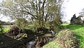
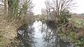
River Colne in Colney Heath
-
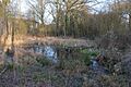
The Commons, Welwyn Garden City
-
River Gade in Croxley Common Moor
-
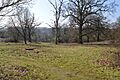
Danesbury Park
-
Fisher's Field
-
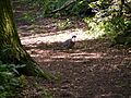
Pigeon in Furzefield Wood
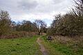
-
Garston Park
-
Harebreaks Wood
-
Hilfield Park Reservoir
-
Howe Dell
-
Howe Grove Wood
-

Spring at Radwell feeding the Ivel
-
The Lairage Land
-
Mardley Heath
-
Marshalls Heath
-
Pond, Northaw Great Wood
-
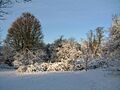
Trees on a snowy Norton Common
-
River Oughton at Oughtonhead Common
-
Oxhey Woods
-
Oxleys Wood
-
Prestwick Road Meadows
-
River Purwell in Purwell Meadows
-
Rickmansworth Aquadrome
-
Sherrardspark Wood
-
Shrubhill Common
-

River Mimram in Singlers Marsh
-
Stanborough Reedmarsh and River Lea
-
Stocker's Lake
-
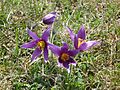
Pulsatilla Vulgaris On Therfield Heath
-
Top Field
-
Watercress Wildlife Site
-
Waterford Heath
-
Weston Hills
-
Wheathampstead LNR
-
The Wick LNR
-
The Withey Beds


Find Out More
