
List of mills in Calderdale facts for kids

This article is about the many textile mills that once thrived in Calderdale, England. Calderdale includes towns like Halifax, Brighouse, Todmorden, Elland, Hebden Royd, and Ripponden. These mills were huge factories where wool, cotton, and other materials were turned into fabric. They were a very important part of life and work in this area, especially during the time known as the Industrial Revolution.
Contents
What Were Textile Mills?
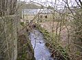
Textile mills were factories that used machines to make cloth. Before these mills, people often made cloth by hand in their homes. But with new inventions like the spinning jenny and power loom, large machines could do the work much faster. These machines needed big buildings and lots of power, often from water or steam engines.
Calderdale was a perfect place for mills because it had:
- Plenty of fast-flowing rivers to power early machines.
- Coal nearby for steam engines later on.
- A long history of making woollen cloth.
These mills created many jobs and helped the towns grow. They were busy places, full of noise and activity, making clothes and fabrics that were sold all over the world.
Mills Across Calderdale
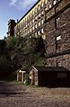
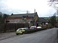
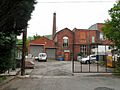
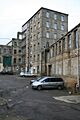
Calderdale was home to hundreds of textile mills. Each town and village had its own important mills, contributing to the region's fame for making textiles. Many of these old mill buildings still stand today, often repurposed for new uses like homes or offices, reminding us of their rich history.
Barkisland (Ripponden) Mills
In the area of Barkisland, near Ripponden, there were several important mills. These included places like Barkisland Mills and Bowers Mills. These factories played a key role in making textiles in this part of Calderdale.
Brighouse Area Mills
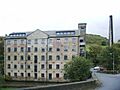
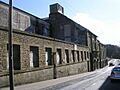
The towns around Brighouse, including Clifton and Hipperholme, were also busy with mills. Places like Bailliff Bridge Mill and Millroyd Mills were central to the textile industry here. Many of these mills helped turn raw materials into finished cloth. Some, like Perseverance Mill, are now Grade II listed buildings, meaning they are protected for their historical importance.
Hebden Royd Area Mills
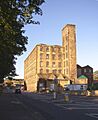
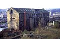
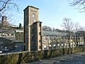
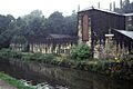
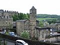
Hebden Royd and nearby areas like Erringden, Heptonstall, and Midgley had many mills nestled in the valleys. Famous examples include Gibson Mill, which is a beautiful old building, and Nutclough Mill. These mills often used the fast-flowing rivers of the Calder Valley for power. Many of these historic buildings are now protected as Grade II listed buildings, showing their value.
Halifax Mills
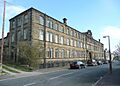
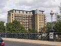
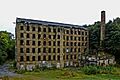
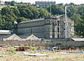
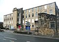
Halifax was a major centre for textile production. It had a large number of mills, such as Dean Clough Mills and Old Lane Mill. Dean Clough, in particular, was one of the biggest carpet factories in the world! Many of these mills were huge complexes that employed thousands of people. Some, like Stone Dam Mill and Garden Street Mills, have been given new life as shops or homes.
Todmorden Area Mills
Todmorden and its surrounding areas like Cliviger, Langfield, and Stansfield were also full of mills. Places like Woodhouse Mill and Robinwood Mill were important for making cotton and other textiles. The area's rivers and canals were vital for transporting goods to and from these busy factories. Mons Mill was a large cotton mill that operated for many years.
Sowerby Bridge Area Mills
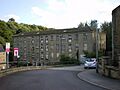
Sowerby Bridge, along with Norland, Soyland, and Warley, had many mills. These included places like Asquith Bottom Mills and Shaw Lodge Mills. Many of these mills were involved in spinning and weaving wool and cotton. Lumb Mill, for example, started as a cotton mill and later switched to making worsted fabric. Some, like Sowerby Bridge Mills, are now protected as Grade II listed buildings.
Wyke Mills
Wyke, near Brighouse, also had its share of textile mills. City Shed and Wyke Mills were among the important factories in this area, contributing to the region's textile output.
Images for kids
-
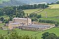
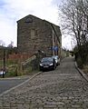
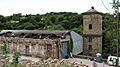
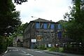
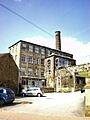
Barkisland Mill
-
Bowers Mills
-
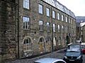
Firth House Mills
-
Dunkirk Mills
-
Pellon Lane Mills
-
Stone Dam Mill
-
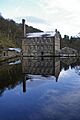
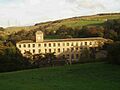
Gibson Mill
-
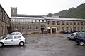
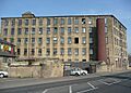
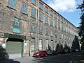
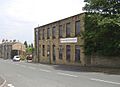
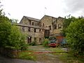
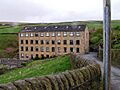
Millroyd Mills
-
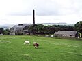
North Vale Mills
-
Perseverance Mill
-
Woodvale Mills
-
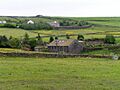
Woodhouse Mill
-
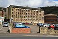
Oats Royd Mills
-
Valley Mills
-
Bowling Dyke Mills
-
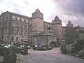
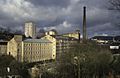
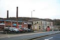
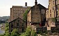
Dean Clough Mills
-
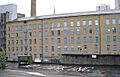
Garden Street Mills
-
Haley Hill Mills
-
Ladyship Mills
-
Old Lane Mill
-
Slade Lane Mill
-
Rishworth Mills
-
Shaw Lodge Mills
-
Bottoms Mill
-
Boys Mill (Phoebe Lane Mill)
-
Asquith Bottom Mills
-
Fairlea Mill
-
Excelsior Mills
-
Kebroyd Mills
-
Birks Mill
-
Bottoms Mill
-
Gauxholme Mill
-
Hollins Mill
-
Hope Mill
-
Jubilee Mill
-
Robinwood Mill
-
Stoneswood Mill
-
Croft Mill
-
Nutclough Mill
-
Old Town Mill
-
Pecket Well Mill
-
Lumb Mill
-
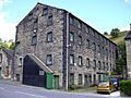
Sowerby Bridge Mills
-
Wainstalls New Mill


.jpg)


.jpg)


.jpg)

.jpg)

.jpg)
.jpg)


.jpg)


See also
- Heavy Woollen District
- Textile processing
