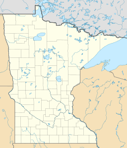
Little Rock Lake (Benton County, Minnesota) facts for kids
Quick facts for kids Little Rock Lake |
|
|---|---|
| Location | Benton County, Minnesota, United States |
| Coordinates | 45°44′18″N 94°10′02″W / 45.73833°N 94.16722°W |
| Type | Reservoir |
| Primary inflows | Mississippi River |
| Primary outflows | Mississippi River |
| Basin countries | United States |
| Surface area | 2.27 mi² (5.87 km²) |
| Max. depth | 23 ft (7.0 m) |
| Surface elevation | 1,015 ft (309 m) |
Little Rock Lake is a special kind of lake called a reservoir. It's located in Benton County, Minnesota, in the United States. This lake wasn't formed naturally. Instead, it was created by people in 1911.
Little Rock Lake: A Minnesota Reservoir
Little Rock Lake was made by building a dam across the Mississippi River. This dam, called the Sartell Dam, is about 5 miles (8 kilometers) downstream from the lake. When the dam was built, it held back the river's water, forming the large body of water we now know as Little Rock Lake. The lake gets its name from a smaller stream, Little Rock Creek, which flows into it.
Exploring the Lake
If you want to visit Little Rock Lake, there are two places where you can launch a boat. These are called public boat access points. They make it easy for people to enjoy boating, fishing, or just exploring the water.
Water Quality and Plant Life
The water in Little Rock Lake isn't very clear. You can usually only see less than 1.5 feet (0.45 meters) deep into the water. This low clarity means the water might look a bit cloudy. Also, there are hardly any aquatic plants growing in the lake. Aquatic plants are important for many lake ecosystems, providing food and shelter for animals.
 | George Robert Carruthers |
 | Patricia Bath |
 | Jan Ernst Matzeliger |
 | Alexander Miles |


