Little Zigzag River facts for kids
Quick facts for kids Little Zigzag River |
|
|---|---|

Mount Hood and vicinity
|
|
|
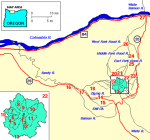
Location of the mouth of the Little Zigzag River in Oregon
|
|
| Country | United States |
| State | Oregon |
| County | Clackamas County |
| Physical characteristics | |
| Main source | Zigzag Glacier Mount Hood 6,989 ft (2,130 m) 45°20′52″N 121°43′03″W / 45.34778°N 121.71750°W |
| River mouth | Zigzag River Oregon 3,071 ft (936 m) 45°18′45″N 121°47′58″W / 45.31250°N 121.79944°W |
| Length | 5 mi (8.0 km) |
The Little Zigzag River is a small river, about 5 miles (8.0 km) long. It flows into the Zigzag River in the state of Oregon, United States. Both the Zigzag and Little Zigzag rivers get their water from the Zigzag Glacier. This glacier is located on Mount Hood, a tall volcano in the Cascade Range.
The water from these rivers flows west. It eventually joins the Sandy River near the town of Zigzag. A popular spot along the river is Little Zigzag Falls. You can find these falls near U.S. Route 26, just east of Zigzag.
The River's Journey
The Little Zigzag River starts high up on Mount Hood. Its source is at the beginning of Little Zigzag Canyon. This area is at the southern edge of the Zigzag Glacier. The upper parts of the river are inside the Mount Hood Wilderness. This wilderness is part of the larger Mount Hood National Forest.
River's Surroundings
To the river's right side, you'll see a steep cliff called the Mississippi Head escarpment. This is also where the Zigzag Canyon begins. The Zigzag River, which also comes from the Zigzag Glacier, starts here too. On the left side of the Little Zigzag River is the Palmer Glacier.
From its source, the river flows towards the southwest. It crosses two famous hiking paths: the Timberline Trail and the Pacific Crest Trail (PCT). These crossings happen a little west of Timberline Lodge.
Downstream Flow
Further downstream from the Pacific Crest Trail, the river runs next to the Hidden Lake Trail. This trail follows a ridge, which is a raised strip of land, on the right side of the canyon. A stream from Sand Canyon joins the Little Zigzag from the left. This happens as the river flows near Hidden Lake, which is on the right.
Soon after, the river leaves the wilderness area. It then turns west and passes close to U.S. Route 26. This highway is on the river's left side. In its final section, the river flows past the Mt. Hood Kiwanis Camp. This camp is on the left bank. The river then goes under Kiwanis Camp Road (also called Forest Road 39). Finally, it flows into the Zigzag River.
River's Steepness
The Little Zigzag River drops about 3,918 feet (1,194 m) from where it starts to where it ends. This means it has a steep average slope. Its gradient is about 800 feet per mile (150 m/km). Little Zigzag Falls, a favorite hiking spot, is only about 0.3 miles (0.48 km) east of a parking area at the end of Forest Road 39.
 | Laphonza Butler |
 | Daisy Bates |
 | Elizabeth Piper Ensley |


