Livermore, Colorado facts for kids
Quick facts for kids
Livermore, Colorado
|
|
|---|---|

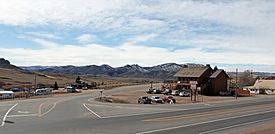
Livermore in 2014
|
|
| Country | |
| State | |
| County | Larimer |
| Elevation | 5,896 ft (1,797 m) |
| Time zone | UTC-7 (MST) |
| • Summer (DST) | UTC-6 (MDT) |
| ZIP code |
80536
|
| Area code(s) | 970 |
| GNIS feature ID | 0170174 |
Livermore is a small place in Larimer County, Colorado, United States. It's known as an unincorporated community, which means it doesn't have its own local government like a city or town. Instead, it's managed by the county. Livermore also has its own U.S. Post Office with the ZIP Code 80536.
History of Livermore
The post office in Livermore first opened its doors in 1871. People say the name "Livermore" came from combining the names of two early settlers, Livernash and Moore. This is a common way many places got their names long ago!
Where is Livermore Located?
Livermore is found in a beautiful part of Colorado. It sits at an elevation of about 5,896 feet (which is about 1,797 meters) above sea level. This means it's quite high up in the mountains! You can find Livermore on a map using its coordinates: 40°47′40″N 105°13′00″W / 40.79444°N 105.21667°W.
 | Roy Wilkins |
 | John Lewis |
 | Linda Carol Brown |


