Loburn facts for kids
Quick facts for kids
Loburn
|
|
|---|---|

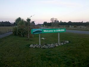
Welcome sign to Loburn, looking east towards Loburn School (2013).
|
|
| Country | New Zealand |
| Region | Canterbury |
| Territorial authority | Waimakariri District |
| Ward | Rangiora-Ashley Ward |
| Community | Rangiora-Ashley Community |
| Electorates |
|
| Area | |
| • Rural | 89.32 km2 (34.49 sq mi) |
| Elevation
(Loburn Abbey Airfield)
|
116 m (380 ft) |
| Population
(June 2023)
|
|
| • Rural | 2,420 |
| • Density | 27.09/km2 (70.17/sq mi) |
| Time zone | UTC+12 (NZST) |
| • Summer (DST) | UTC+13 (NZDT) |
| Postcode |
7472
|
| Area code(s) | 03 |
Loburn is a small, rural community in North Canterbury, New Zealand. It is about 10 kilometres northwest of Rangiora and nearly 50 kilometres north of Christchurch.
Loburn is a quiet place with no shops. People here work in different ways. Some local businesses include a cheese factory and fruit orchards. Many farms in the area raise animals like sheep, cattle, and even emu.
Contents
Geography of Loburn
Loburn is located at the very northern edge of the flat Canterbury Plains. It is surrounded by rivers: the Ashley River (also called Rakahuri) to the south and the Okuku River to the west.
To the north, you'll find hills like Mount Grey (933 metres high) and Mt Karetu (972 metres high). To the east, there's the Ashley forest.
Land Features and Fault Lines
The land in Loburn is mostly flat with some gentle rolling hills. The height of the land slowly gets lower as you go south from the hills.
There's a special area called the Loburn-Ashley fault zone. This zone runs from the northern banks of the Ashley River towards Hodgsons Road. A fault is like a crack in the Earth's crust. The Loburn fault, which runs along the south side of Hodgsons Road, has created interesting land features. These include old stream channels that look like steps, and small cliffs called fault scarps, like the one at Round Hill.
People of Loburn
The Loburn area covers about 89.32 square kilometres. As of June 2023, an estimated 2,420 people live here. This means there are about 27.09 people per square kilometre.
Population Growth
Loburn has been growing! In 2018, the population was 2,175 people. This was a jump of 234 people (12.1%) since 2013, and a big increase of 837 people (62.6%) since 2006.
There were 735 homes in 2018. The population was almost evenly split between males (1,098) and females (1,077). The average age was 45.4 years. About 19% of the people were under 15 years old, and 12.6% were 65 or older.
Cultural Backgrounds
Most people in Loburn are of European background (95.7%). There are also people who identify as Māori (6.2%), Pasifika (1.4%), and Asian (1.5%), along with other ethnicities. Some people identify with more than one background.
About 20.7% of the people living in Loburn were born outside New Zealand.

Beliefs and Work
When asked about their beliefs, 57.4% of people said they had no religion. About 32.7% were Christian, and smaller numbers followed other religions like Hinduism or Buddhism.
Many people in Loburn are employed. About 53.5% work full-time, and 19.8% work part-time. The average income was $36,900.
Education in Loburn
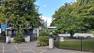
Loburn has two primary schools for children.
Loburn School
Loburn School was established in 1869, making it quite old! It is a state primary school for both boys and girls. As of 163 February 2024 , it has 163 studentsFebruary 2024 .
North Loburn School
North Loburn School started a bit later, in 1882. It is also a state primary school for both boys and girls. As of 82 February 2024 , it has 82 studentsFebruary 2024 .


