Ashley River / Rakahuri facts for kids
Quick facts for kids Ashley River / Rakahuri |
|
|---|---|
 |
|
| Native name | Rakahuri |
| Country | New Zealand |
| Region | Canterbury |
| Physical characteristics | |
| Main source | Puketeraki Range 1,802 m (5,912 ft) |
| River mouth | Pacific Ocean Waikuku Beach 0 m 43°16′S 172°43′E / 43.267°S 172.717°E |
| Length | 65 km (40 mi) |
| Basin features | |
| Basin size | 1,200 km2 (460 sq mi) |
| Tributaries |
|
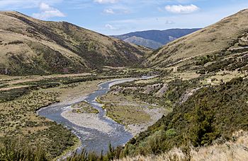
The Ashley River / Rakahuri is a cool river in the Canterbury area of New Zealand. It flows for about 65 kilometers (40 miles) towards the southeast. Finally, it reaches the Pacific Ocean at Waikuku Beach, which is north of Christchurch. The town of Rangiora is also very close to the river's south side. The river's name was officially changed to Ashley River / Rakahuri in 1998 to include its Māori name, Rakahuri.
The lower parts of the river look like a braided river. This means it splits into many smaller channels that weave around islands of gravel and sand. However, the upper part of the river flows through a deep valley called the Ashley Gorge. The river starts high up in the Puketeraki Range mountains. It gathers water from many smaller streams and valleys as it flows down.
Contents
Amazing Wildlife at the River
Near Waikuku Beach, there is a large and important estuary. An estuary is where the river meets the sea, mixing fresh and saltwater. This area is very special because it has lots of birds.
Some of the unique birds you might see include:
- The wrybill (Anarhynchus frontalis), which has a beak that bends to the side!
- The Black stilt (Himantopus novaezelandiae), a very rare black wading bird.
Many birds that travel long distances also spend their winters here. From 2000 to 2015, people worked hard to clear weeds and pests from the estuary. After this, surveys showed more banded dotterel, wrybill, black-fronted tern, and pied stilt birds.
How the River is Protected from Floods
The Ashley River / Rakahuri has flooded many times in the past. Some big floods happened in 1868, 1905, and 1923, reaching as far as Kaiapoi. Other major floods occurred in 1902, 1936, 1941, 1945, 1953, 1993, and 2013.
To stop these floods, people built special walls called stopbanks (a type of levee). About 34.7 kilometers (21.6 miles) of stopbanks have been built since the 1930s. These walls have helped control floods since 1953. They were made even bigger in 1976 and 2018. The stopbanks run along both sides of the river, protecting the land nearby.
Important Bridges Crossing the River
Several important bridges cross the Ashley River / Rakahuri, helping people and trains get around.
Cones Road Bridge
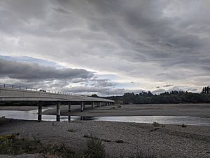
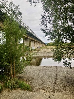
The Cones Road Bridge connects Rangiora to Ashley and Loburn. It is a long bridge, about 300 meters (980 feet) long, with 10 sections. This bridge opened in 2015. It replaced an older bridge from 1912 that was damaged by floods in 2013. The new bridge is made of strong concrete beams. It has two lanes for cars, two paths for bikes, and a footpath for people walking.
Railway Bridge
The first railway bridge over the Ashley River opened in 1875. It was very long, about 3055 feet (931 meters), and made of wood. In 1951, a flood washed away part of it. A new, stronger railway bridge was built to the east and opened in 1961. This bridge is 549 meters (1801 feet) long.
Main North Road Bridge
The first bridge for the Main North Road was finished in 1866. It was first a toll bridge, meaning you had to pay to cross. But by 1867, the local government bought it. After floods, it was made longer in 1868. A new, stronger bridge was built nearby and opened in 1937. This bridge is 1190 feet (360 meters) long and 22 feet (6.7 meters) wide. It is now part of State Highway 1, a major road in New Zealand. It was repaired and made stronger again in 2019.
 | Shirley Ann Jackson |
 | Garett Morgan |
 | J. Ernest Wilkins Jr. |
 | Elijah McCoy |


