Loch Màma facts for kids
Quick facts for kids Loch Màma |
|
|---|---|

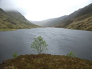
Loch Màma from the far western shore
|
|
| Lua error in Module:Location_map at line 420: attempt to index field 'wikibase' (a nil value). | |
| Location | Morar, Lochaber, Scotland |
| Type | freshwater loch |
| Primary inflows | Loch na Creige Duibhe |
| Primary outflows | Gleann Màma |
| Basin countries | Scotland |
| Max. length | 0.33 mi (0.53 km) |
| Max. width | 0.125 mi (0.201 km) |
| Surface area | 17 acres (0.069 km2) |
| Average depth | 14.25 ft (4.34 m) |
| Max. depth | 44 ft (13 m) |
| Water volume | 11,000,000 cu ft (310,000 m3) |
| Surface elevation | 359 ft (109 m) |
Loch Màma is a small, beautiful freshwater loch (that's a Scottish word for lake!) located in a part of Scotland called South Morar. You can find it in Lochaber, which is in the north-west of Scotland. This loch has a simple shape, like a bowl, and stretches from east to west.
Contents
About Loch Màma
Loch Màma is a lovely example of a Scottish loch. It's not huge, but it's an important part of the local landscape. It's known for its clear, fresh water.
Where is Loch Màma?
This loch is nestled in the stunning Highlands of Scotland. It's part of the Morar area, which is famous for its rugged mountains and many lochs. The surrounding area is very wild and natural.
How the Loch Formed
Scientists believe that Loch Màma and a nearby loch, Loch na Creige Duibhe, were once connected. They might have been one big loch! Over time, a stream called Allt Dearg carried lots of dirt and rocks. This material built up and slowly separated the two lochs. Now, they are two distinct bodies of water.
The Source of a River
Loch Màma is also special because it's the starting point for a river. The water flowing out of the loch forms the river Allt a' Mhama. This river then continues its journey through the Scottish landscape.
Exploring the Loch
People have been interested in studying Loch Màma for a long time. On July 11, 1902, two explorers named James Parsons and T.R.H. Garrett surveyed the loch. They carefully measured its size and depth. Their work was part of a much bigger project. This project was called the Bathymetrical Survey of Fresh-Water Lochs of Scotland 1897-1909. It was led by famous oceanographer Sir John Murray and Laurence Pullar. They created detailed maps of many Scottish lochs.

