Loks Land facts for kids

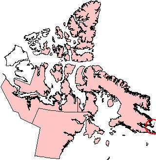
Loks Land, Nunavut (red circle at right edge)
|
|
| Geography | |
|---|---|
| Location | Frobisher Bay |
| Coordinates | 62°26′N 64°38′W / 62.433°N 64.633°W |
| Archipelago | Arctic Archipelago |
| Area | 419 km2 (162 sq mi) |
| Coastline | 206 km (128 mi) |
| Administration | |
|
Canada
|
|
| Territory | Nunavut |
| Region | Qikiqtaaluk |
| Demographics | |
| Population | Uninhabited |
Loks Land is an island in the far north of Canada. It's part of the Arctic Archipelago, a huge group of islands near the North Pole. This island is found in Nunavut, Canada's largest and northernmost territory.
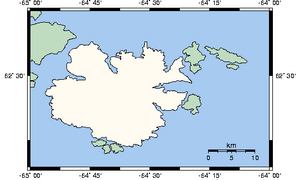
Loks Land is not lived on by people. It sits near the eastern tip of Baffin Island, close to where Frobisher Bay opens up. The island covers about 419 square kilometers (162 square miles). Its coastline stretches for 206 kilometers (128 miles). The local Inuktitut name for this island is Takuligjuaq.
A Look at Loks Land's Past
Loks Land was once home to a special station. This station was part of the Distant Early Warning Line. This was a chain of radar stations built across the Arctic during the Cold War.
These stations were set up to detect if any planes or missiles were coming over the North Pole. Loks Land's station had the code number BAF-4A. It played a role in protecting North America.
How Loks Land Got Its Name
The island was visited by an explorer named Martin Frobisher. He was an English sailor who made several trips to the Arctic in the 1570s. Loks Land is named after Michael Lok.
Michael Lok was a rich businessman from London. He helped pay for Frobisher's trips to the Arctic. During Frobisher's first trip, his crew found some rocks. They thought these rocks contained gold.
This made people very excited! So, Frobisher went on two more trips to find more of this "gold." However, they never found any real gold. These trips cost Michael Lok a lot of money.
See also
 In Spanish: Isla Loks Land para niños
 | Janet Taylor Pickett |
 | Synthia Saint James |
 | Howardena Pindell |
 | Faith Ringgold |


