Lone Mountain State Forest facts for kids
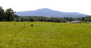
Lone Mountain State Forest is a special natural area in Morgan County, Tennessee, in the southeastern United States. It's like a big park, covering about 3,624 acres (14.67 km²). The Tennessee Department of Agriculture takes care of this forest.
Lone Mountain itself is a mountain that stands alone, reaching about 2,530 feet (771 meters) high. Even though it's not the tallest mountain, it stands out because it's so isolated. This makes it one of the 25 most important mountains in Tennessee.
Where is Lone Mountain?
Lone Mountain is found on the western edge of the Crab Orchard Mountains. These mountains are part of the Cumberland Plateau. The Emory River flows along the western side of Lone Mountain. This river starts near Bird Mountain and winds around the base of Lone Mountain before joining Watts Bar Lake.
A stream called Crooked Fork forms the northern edge of Lone Mountain. Another stream, Bitter Creek, creates a large valley on the eastern side. This valley separates Lone Mountain from the rest of the Crab Orchard Mountains.
Lone Mountain is located along U.S. Route 27, a main road between Harriman and Wartburg. The small town of Mossy Grove is right at the eastern base of the mountain, in the Bitter Creek valley.
History of the Forest
Lone Mountain State Forest was created in 1938. A company called the Lone Mountain Land Company donated some land. The next year, the Morgan County Chancery Court bought more land to add to it.
For many years, Lone Mountain was part of a bigger forest called Morgan State Forest. But in 1970, it became its own independent state forest. The State Forestry Division decided to let the forest grow naturally without much interference. This was to help it recover from past activities by the Lone Mountain Land Company. Because of this, trees are not often cut down in the forest.
In 2002, a strong tornado hit Morgan County. It caused a lot of damage in Mossy Grove and destroyed about 500 acres (2.0 km²) of trees in Lone Mountain State Forest. This tornado closed a trail called the Carl Black Spur trail. Forestry officials are working to open it again soon. The tornado also created a chance for a new trail, which was named Twister Pass. It goes from the South West trail up to Todds Landing.
In the 1970s and 1990s, tiny insects called Southern pine beetles attacked the forest. They killed many pine trees. Now, the forest mostly has hardwood trees, which are different types of trees like oaks and maples.
Things to Do at Lone Mountain
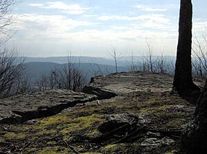
Lone Mountain has about 15 miles (24 km) of trails for you to explore! The most popular trail leads to Coyote Point. This is a great spot to see views from just below the mountain's top.
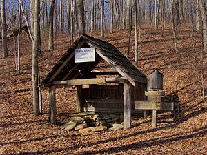
These trails were first made in the late 1980s for people who love to ride horses. They have places to get water and hitching posts for horses. But don't worry, the trails are also open for hikers and mountain bikers! You can find the start of the trails just west of US-27, along Clayton Howard Road.
 | Aurelia Browder |
 | Nannie Helen Burroughs |
 | Michelle Alexander |


