Long Branch (Little Nottoway River tributary) facts for kids
Quick facts for kids Long Branch |
|
|---|---|
| Other name(s) | Tributary to the Little Nottoway River |
| Country | United States |
| State | Virginia |
| County | Nottoway |
| Physical characteristics | |
| Main source | about 0.25 miles southwest of Sneads Spring, Virginia 435 ft (133 m) 37°06′40″N 078°07′08″W / 37.11111°N 78.11889°W |
| River mouth | Little Nottoway River about 2 miles northwest of Blackstone, Virginia 269 ft (82 m) 37°05′39″N 078°03′43″W / 37.09417°N 78.06194°W |
| Length | 3.44 mi (5.54 km) |
| Basin features | |
| Progression | southeast |
| River system | Nottoway River |
| Basin size | 1.61 square miles (4.2 km2) |
| Tributaries |
|
| Bridges | Snead Spring Road Flat Rock Road |
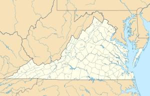
The Long Branch is a small river, about 3.44 miles (5.54 km) long. It's like a smaller stream that flows into a bigger one! This river is a "tributary" to the Little Nottoway River. You can find it in the state of Virginia in the United States. It is located in the southeastern part of Virginia.
Contents
About Long Branch River
Long Branch is part of a much larger water system. This system is called the Chowan-Albemarle drainage. Think of it as a big network of rivers and streams. All these waterways eventually flow into the Albemarle Sound. The Albemarle Sound is a large body of water near the Atlantic Ocean.
Where Does it Start and End?
The Long Branch river begins about 0.25 miles (0.40 km) southwest of a place called Sneads Spring, Virginia. At its start, the river is about 435 feet (133 meters) above sea level. It then flows southeast. The river ends when it joins the Little Nottoway River. This meeting point is about 2 miles (3.2 km) northwest of Blackstone, Virginia. Here, the river is about 269 feet (82 meters) above sea level.
The Land Around the River
The area of land that drains into the Long Branch river is called its "watershed." This watershed covers about 1.61 square miles (4.17 square kilometers). A big part of this land is covered by forests, about 58%. Another large part, 38%, is used for farming. The rest of the land is used for other things.
How People Cross the River
Even though it's a small river, there are a couple of roads that cross over Long Branch. These include Snead Spring Road and Flat Rock Road. These bridges help people travel easily across the area.
 | Percy Lavon Julian |
 | Katherine Johnson |
 | George Washington Carver |
 | Annie Easley |


