
Long Glacier facts for kids
Quick facts for kids Long Glacier |
|
|---|---|

Map of Thurston Island
|
|

Location in Antarctica
|
|
| Location | Ellsworth Land |
| Coordinates | 72°30′00″S 96°43′00″W / 72.50000°S 96.71667°W |
| Length | 8 nautical miles (15 km; 9.2 mi) |
| Thickness | unknown |
| Terminus | Abbot Ice Shelf |
| Status | unknown |
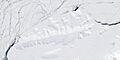
Long Glacier is a large sheet of ice, about 8 nautical miles (about 15 kilometers) long. It is found in the southeastern part of Thurston Island, which is in Antarctica.
This glacier flows south towards the Abbot Ice Shelf. It is located about 14 nautical miles (about 26 kilometers) west of Harrison Nunatak.
Scientists from the United States Geological Survey mapped Long Glacier between 1960 and 1966. They used surveys and photos taken from U.S. Navy airplanes.
The glacier was named by the Advisory Committee on Antarctic Names (US-ACAN). It honors Fred A. Long, Jr., who was an aviation machinist in the U.S. Navy. He spent a winter at Little America V in 1957 and also visited Antarctica in 1960–61 and 1962–63.
Long Bluff: A Nearby Feature
Long Bluff is a noticeable rock cliff located on the west side of Long Glacier. This bluff was also named by the US-ACAN.
It was named after W.A. Long, who was a Chief Pharmacist's Mate in the U.S. Navy. He was part of Operation Highjump in 1946–47.
On January 11, 1947, W.A. Long was on a search flight. He was the first person to spot the wreckage of a seaplane called George One on Noville Peninsula. This discovery helped rescue the people who survived the crash.
Images for kids
-
Satellite image of Thurston Island.

