Long Pines facts for kids
Quick facts for kids Long Pines |
|
|---|---|
| Highest point | |
| Elevation | 4,094 ft (1,248 m) |
| Geography | |
| Country | United States |
| State | Montana |
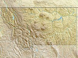
The Long Pines is a small mountain range located in southeastern Montana. It is found in Carter County, Montana, southeast of the town of Ekalaka, Montana. The highest point in the Long Pines reaches about 4,094 feet (1,248 meters) above sea level.
Exploring the Long Pines
The Long Pines are not alone in this part of the country. They are closely connected to three other small mountain ranges nearby. These include the Ekalaka Hills, which are also in Carter County.
Other related ranges are the East Short Pine Hills and the West Short Pine Hills. The East Short Pine Hills are southwest of Buffalo, South Dakota. The West Short Pine Hills are south of Camp Crook, South Dakota. These ranges together form a unique landscape.
Part of a Bigger Forest
The Long Pines area was once known as the Long Pine National Forest. Over time, it became part of a much larger forest system. Today, it is included in the Custer Gallatin National Forest. This means it is managed as part of a bigger natural area.
Most of the Long Pines land unit, which is about 70,969 acres (287.2 km²), is in Carter County, Montana. A smaller part, about 320 acres (1.3 km²), extends east into Harding County, South Dakota.
The Long Pines land unit is managed by the Sioux Ranger District. This district is a part of the Custer Gallatin National Forest. The Ekalaka Hills, East Short Pine Hills, and West Short Pine Hills are also managed by this same district.


