Loosier, Alabama facts for kids
Quick facts for kids
Loosier, Alabama
|
|
|---|---|

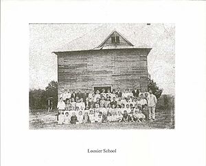
The first School in Loosier, Alabama
|
|
| Country | United States |
| State | Alabama |
| County | Lawrence |
| Elevation | 748 ft (228 m) |
| Time zone | UTC-6 (Central (CST)) |
| • Summer (DST) | UTC-5 (CDT) |
| Area code(s) | 256, 938 |
| GNIS feature ID | 136783 |
Loosier is a small, unincorporated community located in Lawrence County, Alabama, in the United States. An unincorporated community means it's a group of homes and businesses that isn't officially a town or city with its own local government. Instead, it's part of the larger county.
Loosier is found just off Alabama State Route 157. It is about 7.6 miles (12.2 kilometers) northwest of a larger town called Moulton. The area sits at an elevation of about 748 feet (228 meters) above sea level. You can find Loosier marked on the Masterson Mill map, which is created by the U.S. Geological Survey.
History of Loosier
The community of Loosier was founded sometime between 1860 and 1870. It was started by a man named Thomas Jefferson Loosier, who was a veteran of the American Civil War.
For a short time, from 1901 to 1902, Loosier even had its own post office. This was a place where people could send and receive mail. By 1917, the community had grown to include several important buildings. These included one grain mill (for processing crops), one saw mill (for cutting wood), two churches, one school, one general store, and the post office. These places were very important for the people living in Loosier at that time.
 | Frances Mary Albrier |
 | Whitney Young |
 | Muhammad Ali |


