
Lopik facts for kids
Quick facts for kids
Lopik
|
|||
|---|---|---|---|

Canal through Polsbroek
|
|||
|
|||
.svg)
Location in Utrecht
|
|||
| Country | Netherlands | ||
| Province | Utrecht | ||
| Government | |||
| • Body | Municipal council | ||
| Area | |||
| • Total | 78.98 km2 (30.49 sq mi) | ||
| • Land | 75.75 km2 (29.25 sq mi) | ||
| • Water | 3.23 km2 (1.25 sq mi) | ||
| Elevation | 0 m (0 ft) | ||
| Population
(May 2014)
|
|||
| • Total | 14,000 | ||
| • Density | 185/km2 (480/sq mi) | ||
| Time zone | UTC+1 (CET) | ||
| • Summer (DST) | UTC+2 (CEST) | ||
| Postcode |
3405–3415
|
||
| Area code | 0182, 030, 0348 | ||


Lopik (Dutch pronunciation: [ˈloːpɪk]) is a town and a municipality in the Netherlands. It is located in the province of Utrecht, very close to the Lek river.
Contents
History of Lopik
Lopik is part of a region called the Lopikerwaard. Long ago, this area was covered in swamps and forests. Around the 11th century, people started to clear the land for farming.
Lopik was first mentioned in records in the year 1155. Back then, it was called "Lobeke." Most people built their homes along the canals. These canals were important for moving goods and draining water from the land. Even today, they help keep the area dry.
After World War II, the villages in the area grew bigger. Lopik is a great example of a linear settlement. This means its buildings stretch out in a long line, often along a road or canal.
In the Netherlands, "Lopik" is often linked to its tall broadcasting towers. These towers are in the eastern part of the municipality and nearby IJsselstein. One of them is the Gerbrandy Tower. It is the tallest structure in the Netherlands! Around Christmas, this tower even turns into the world's largest Christmas tree.
Geography of Lopik
The entire municipality of Lopik is located within the "Green Heart" of the Netherlands. This area is mostly rural, meaning it has lots of farms and open spaces.
The two main roads that connect Lopik to bigger cities are the N210 and N204. These roads help people travel to places like Rotterdam and Utrecht.
The Lek river flows behind a tall dike. You can see this dike from most of the southern part of Lopik. In the late 1980s and early 1990s, the dike was made stronger and taller. This was done to prepare for higher water levels in the future. There are still plans to keep improving these important dikes.
Towns and Villages
The municipality of Lopik includes several towns, villages, and districts. They are:
- Benschop
- Cabauw
- Jaarsveld
- Lopik
- Lopikerkapel
- Polsbroek
- Polsbroekerdam
- Uitweg
- Willige Langerak
- Zevender
Map of Lopik

Getting Around
Most public transport in Lopik is by bus, mainly run by a company called Syntus. If you want to travel by train, the closest railway stations are in Gouda and Woerden.
Famous People from Lopik
Many interesting people have connections to Lopik:
- Paul Theodor van Brussel (1754–1795) was a Dutch flower painter. He was born in Zuid-Polsbroek.
- Herman de Man (1898–1946) was a Dutch writer who grew up in the Lopikerwaard area.
- Mineke Schipper (born 1938) is a Dutch author and scholar. She was born in Polsbroek.

- Kees van Ieperen (born 1956) is a retired skeet shooter. He competed in the 1980 Summer Olympics.
- Ton Strien (born 1958) is a Dutch politician.
- Tjaarke Maas (1974–2004) was a Dutch painter known for her Russian sacred art.
- Peter Schep (born 1977) is a Dutch cyclist who raced on the track.
- Kees van Buuren (born 1986) is a retired Dutch footballer.
Gallery
-
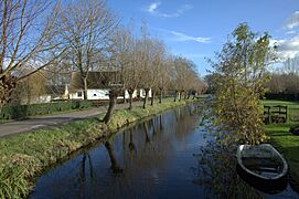
Lopik in November
-
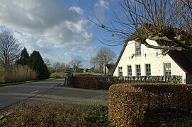
Lopikerwaard
-
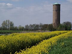
Lopik water tower
-
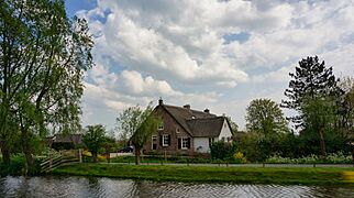
Lopik - panorama


.jpg)
See also
 In Spanish: Lopik para niños
