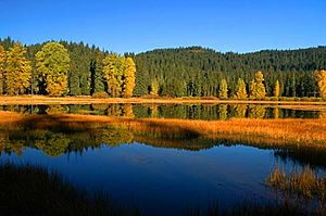
Lost Lake (Santiam Pass, Linn County, Oregon) facts for kids
Quick facts for kids Lost Lake |
|
|---|---|
 |
|
| Location | Linn County, Oregon, United States |
| Coordinates | 44°25′57″N 121°54′34″W / 44.43262°N 121.909506°W |
| Basin countries | United States |
| Max. length | 1 km (0.62 mi) |
| Surface area | 50 acres (20 ha) |
| Surface elevation | 3,983 ft (1,214 m) |
Lost Lake is a cool lake found in the Willamette National Forest in Oregon, United States. It's famous because its water level changes a lot throughout the year. It's like the lake has a secret drain!
About Lost Lake
Lost Lake is located in a beautiful forest area. It's not a very big lake, being about 1 kilometer (0.6 miles) long. The lake sits at a high elevation, about 3,983 feet (1,214 meters) above sea level. What makes Lost Lake special is how its water disappears and reappears.
The Mystery of the Draining Water
Underneath Lost Lake, there are special tunnels called lava tubes. These are like natural pipes formed by ancient lava flows. During the warm summer months, the water in the lake drains away through these lava tubes. Sometimes, so much water drains that the lake almost disappears! It can turn into a grassy field, or a "meadow," with only a small stream left.
But don't worry, the lake doesn't stay empty forever. When autumn arrives, the lake starts to fill up again. This happens because more water flows into the lake from streams and melting snow than flows out. By spring, Lost Lake is usually full of water again, reaching its highest level. It's a fascinating natural cycle!
Where Does the Water Go?
Scientists believe that the water which drains from Lost Lake travels underground. It's thought to flow through the lava tubes to another nearby lake. This lake is called Clear Lake. So, the water from Lost Lake might be helping to fill up Clear Lake!
 | James Van Der Zee |
 | Alma Thomas |
 | Ellis Wilson |
 | Margaret Taylor-Burroughs |

