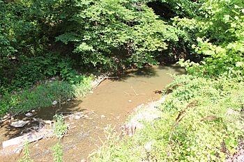
Lotts Creek (Perry, Kentucky) facts for kids
Quick facts for kids Lotts Creek |
|
|---|---|

Lotts Creek
|
|
| Physical characteristics | |
| Main source | Young's Fork headwaters 37°16′55″N 83°01′53″W / 37.28191°N 83.03141°W |
| 2nd source | Kelly/Big Fork headwaters 37°16′20″N 83°00′53″W / 37.27225°N 83.01484°W |
| 3rd source | Clear Fork headwaters 37°16′55″N 83°05′19″W / 37.28198°N 83.08853°W |
| 4th source | Grigsby Creek headwaters 37°17′40″N 83°07′57″W / 37.29453°N 83.13238°W |
| River mouth | North Fork Kentucky River North Fork tributaries at Hazard, Kentucky 820 feet (250 m) 37°16′57″N 83°11′32″W / 37.28260°N 83.19234°W |
| Width |
|
Lotts Creek is a creek that flows through Perry County and Knott County, Kentucky in the United States. It's like a smaller river that eventually joins a bigger one called the North Fork Kentucky River. This meeting point is near a place called Darfork, about 3 miles (4.8 km) downstream from Hazard.
Lotts Creek is about 8.5 miles (13.7 km) long. It starts where two smaller streams, Young's Fork and Kelly Fork, come together. The name "Lotts" most likely comes from a person named William Harrison Lott. However, some old maps spelled it "Lots." One story says this spelling came from a landowner named "Danger Nick" Combs, who divided his land into "lots." But in 1939, the U.S. Board on Geographic Names decided that "Lotts" was the correct spelling.
Contents
Lotts Creek's Journey
Lotts Creek flows generally towards the northwest. Its starting point, where it joins the North Fork Kentucky River, is about 820 feet (250 m) above sea level. A highway bridge crosses the creek at this spot, about 842 feet (257 m) high.
As the creek flows, it drops about 22.64 feet for every mile (4.29 m per km). For most of its path, Lotts Creek winds through valleys filled with trees. In some areas, like near Grigsby, it widens to about 10 to 12 feet (3.0 to 3.7 m). The creek bed is mostly rocky, but in its wider lower half, where it can be 20 to 25 feet (6.1 to 7.6 m) wide, you can find sand bars and gravel islands.
Streams Joining Lotts Creek
Many smaller streams, called tributaries, flow into Lotts Creek along its journey. Here are some of the main ones:
- Trace Fork: Joins Lotts Creek about 1 mile (1.6 km) upstream, at an altitude of 825 feet (251 m).
- Grigsby Creek: Joins Lotts Creek upstream from the Lotts Creek Community Church.
- Elk Fork: Joins Lotts Creek about 5.5 miles (8.9 km) upstream, at an altitude of 945 feet (288 m).
- Clear Fork: Joins Lotts Creek about 6 miles (9.7 km) upstream, at an altitude of 960 feet (290 m).
- Dickson Branch: Joins Lotts Creek about 8.25 miles (13.28 km) upstream, at an altitude of 1,005 feet (306 m).
- Young's Fork: Joins Lotts Creek about 9.75 miles (15.69 km) upstream, at an altitude of 1,060 feet (320 m).
- Buck Branch: Joins Young's Fork about 0.5 miles (0.80 km) upstream.
- Elk Lick Fork: Joins Young's Fork about 1.25 miles (2.01 km) upstream, at an altitude of 1,140 feet (350 m).
- Kelly Fork (also known as Big Fork): Joins Lotts Creek about 9.75 miles (15.69 km) upstream, at an altitude of 1,060 feet (320 m).
Communities Along Lotts Creek
Several small communities and post offices have been located along Lotts Creek over the years.
Darfork Community
The name "Darfork" has been spelled in many ways, like "Danfork" or "Darkfork." Darfork was once a coal town, a railway station, and had a post office. It was used by the Darb Fork Coal Company and was actually about 0.5 miles (0.80 km) upstream from where Lotts Creek meets the bigger river.
The post office opened on December 12, 1927. It was first going to be called Tauber or Urschel. Tauber was the name of a train station on a local railway line that ran along Lotts Creek. This train line even had another branch going up a stream that was then called Danger Fork. Later, the Darfork post office moved around a few times and finally closed in 1965.
Grigsby Community
Grigsby Creek was named after the Grigsby family, who were early settlers in the area. A post office called Grigsby opened on October 5, 1904, near the mouth of Grigsby Creek. It closed in 1933. In 1918, a person named D. Grigsby had a mine here.
Cordia Community
The Cordia post office opened on October 10, 1899. No one is quite sure where the name "Cordia" came from. It might have been named after the postmaster's sister or another local woman. The post office was probably located where a smaller stream called Coles Fork joins Lotts Creek. It later moved downstream near the Lotts Creek (or Cordia) school, which was built in 1933. The Cordia post office closed in 1957.
Elic Community and the Forks
The Elic post office opened on August 4, 1908. It was first located on Kelly Fork, about 3 miles (4.8 km) upstream from where Cordia was at the time. It was named after Alexander "Elic" Young. The post office later moved about 0.5 miles (0.80 km) along Young's Fork and closed in 1934.
In 1918, several people had mines in this area. Mansard Young had a mine on Buck Branch, and Reese Young had one on a smaller branch of Young's Fork. John Young owned land further upstream on Young's Fork, and William Young had a mine on Elk Lick Fork. Thomas Kelly and Benjamin Everidge also had mines on Kelly Fork.
 | Shirley Ann Jackson |
 | Garett Morgan |
 | J. Ernest Wilkins Jr. |
 | Elijah McCoy |

