Perry County, Kentucky facts for kids
Quick facts for kids
Perry County
|
||
|---|---|---|

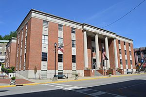
County courthouse in Hazard
|
||
|
||

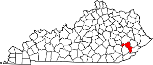
Location within the U.S. state of Kentucky
|
||
 Kentucky's location within the U.S. |
||
| Country | ||
| State | ||
| Founded | November 2, 1820 | |
| Named for | Oliver Hazard Perry | |
| Seat | Hazard | |
| Largest city | Hazard | |
| Area | ||
| • Total | 343 sq mi (890 km2) | |
| • Land | 340 sq mi (900 km2) | |
| • Water | 2.9 sq mi (8 km2) 0.9% | |
| Population
(2020)
|
||
| • Total | 28,473 | |
| • Estimate
(2023)
|
27,133 |
|
| • Density | 83.01/sq mi (32.05/km2) | |
| Time zone | UTC−5 (Eastern) | |
| • Summer (DST) | UTC−4 (EDT) | |
| Congressional district | 5th | |
Perry County is a county located in the state of Kentucky in the United States. In 2020, about 28,473 people lived there. Its main town, or county seat, is Hazard. The county was started in 1820. Both Perry County and its county seat, Hazard, are named after Commodore Oliver Hazard Perry. He was a brave naval hero from the War of 1812.
Contents
History of Perry County
The land that is now Kentucky used to be part of Virginia. This was before the British colonies became the United States during the American Revolutionary War. In 1780, this large area was split into three smaller counties. Then, in 1791, this land became the State of Kentucky. It officially started on June 1, 1792.
Over time, these first counties were divided many times. By 1820, Perry County was created from parts of Floyd and Clay counties. The first post office in the area opened in 1824. It was called the Perry Post Office and was located on the north fork of the Kentucky River. Some of the first people to settle here were Elijah Combs, his seven brothers, and Jade Miller.
For a long time, the main ways people made a living in Perry County were by cutting down trees (logging) and digging for coal (mining).
Perry County is also home to Hazard Community and Technical College. This college helps people learn new skills. The Hazard ARH Regional Medical Center is also here. It is a big hospital system that helps many people in southeastern Kentucky and southern West Virginia. It is one of the largest employers in the area.
Geography of Perry County
Perry County covers a total area of about 343 square miles. Most of this area, about 340 square miles, is land. The rest, about 2.9 square miles, is water.
Counties Nearby
Perry County shares its borders with several other counties:
- Breathitt County (to the north)
- Knott County (to the northeast)
- Letcher County (to the southeast)
- Harlan County (to the south)
- Leslie County (to the west)
- Clay County (to the northwest)
- Owsley County (to the northwest)
People of Perry County
| Historical population | |||
|---|---|---|---|
| Census | Pop. | %± | |
| 1830 | 3,330 | — | |
| 1840 | 3,089 | −7.2% | |
| 1850 | 3,092 | 0.1% | |
| 1860 | 3,950 | 27.7% | |
| 1870 | 4,274 | 8.2% | |
| 1880 | 5,607 | 31.2% | |
| 1890 | 6,331 | 12.9% | |
| 1900 | 8,276 | 30.7% | |
| 1910 | 11,255 | 36.0% | |
| 1920 | 26,042 | 131.4% | |
| 1930 | 42,186 | 62.0% | |
| 1940 | 47,828 | 13.4% | |
| 1950 | 46,566 | −2.6% | |
| 1960 | 34,961 | −24.9% | |
| 1970 | 26,259 | −24.9% | |
| 1980 | 33,763 | 28.6% | |
| 1990 | 30,283 | −10.3% | |
| 2000 | 29,390 | −2.9% | |
| 2010 | 28,712 | −2.3% | |
| 2020 | 28,473 | −0.8% | |
| 2023 (est.) | 27,133 | −5.5% | |
| U.S. Decennial Census 1790-1960 1900-1990 1990-2000 2010-2020 |
|||
In 2000, there were 29,390 people living in Perry County. There were 11,460 households, which are groups of people living together. About 8,491 of these were families. The county had about 86 people per square mile.
Most people in the county, about 97.34%, were White. About 1.64% were Black or African American. A small number of people were Native American, Asian, or from other backgrounds. About 0.52% of the people were Hispanic or Latino.
About 34.20% of households had children under 18 living with them. More than half, 56.70%, were married couples living together. About 23.30% of all households were made up of people living alone.
The average age of people in the county was 36 years old. About 24.40% of the population was under 18. About 11.20% were 65 years or older.
Education in Perry County
Perry County has several schools that help kids learn and grow.
Public Schools
The county has two main public school districts:
Perry County Schools
This school district serves most of the county, except for the city of Hazard.
- Buckhorn Elementary School
- Buckhorn High School
- East Perry Elementary School
- Perry County Central High School
- Robinson Elementary School
- R.W. Combs Elementary School
- West Perry Elementary School
- Viper Elementary School
Hazard Independent Schools
This district mainly covers the city of Hazard.
- Hazard High School
- Hazard Middle School
- Roy G. Eversole Elementary School
Private Schools
- Hazard Christian Academy
Economy of Perry County
The economy in Perry County has historically been very connected to the coal industry.
Coal Companies in Perry County
Several coal companies have operated in Perry County:
- Arch Coal
- James River Coal Company
- TECO Coal
Media in Perry County
People in Perry County can get news and entertainment from different TV, radio, and newspaper sources.
Television
- WYMT-TV
- WKHA-TV, which is a station that gets its programs from Kentucky Educational Television
Radio
- WSGS
- WKIC
- WJMD
- WEKH, which gets its programs from WEKU
- WQXY
- WLZD-LP
Newspapers
- Hazard Herald
Transportation in Perry County
Public transportation is available through LKLP Community Action Partnership. They offer rides that you can request and also have set routes in Hazard. These routes connect to nearby towns like Hindman, Hyden, and Whitesburg.
Communities in Perry County
Perry County has several towns and smaller communities.
Cities
- Buckhorn
- Hazard (This is the county seat, the main town for the county government.)
- Vicco (part of this city is in Perry County)
Census-Designated Places
These are areas that are like towns but are not officially incorporated as cities.
Other Unincorporated Places
These are smaller communities that are not part of a city or a census-designated place.
- Allais
- Allock
- Ary
- Avawam
- Beehive
- Blue Diamond
- Boat
- Bonnyman
- Bulan
- Busy
- Butterfly
- Chavies
- Christopher
- Clemons
- Combs
- Cornettsville
- Curly Fork
- Daisy
- Darfork
- Defiance
- Delphia
- Dice
- Doorway
- Dow
- Dunraven
- Dwarf
- Eversole
- Farler
- Fourseam
- Fusonia
- Gays Creek
- Glomawr
- Grigsby
- Happy
- Happy Valley
- Hardburly
- Harveyton
- Hilton
- Hiner
- Hurricane
- Johnson
- Jones
- Kodak
- Krypton
- Lamont
- Leatherwood
- Lead Branch
- Lothair
- Middle Fork
- Miller
- Mudlick
- Napfor
- Olivers
- Otter Creek
- Red Hill
- Rock Fork
- Saul
- Scuddy
- Sixteen
- Slemp
- Stacy
- Tenmile
- Tilford
- Tribbey
- Typo
- Upper Pidgeonroost
- Viper
- Wentz
- Whitaker
- Whitsett
- Woodland Park
- Yerkes
Ghost Towns
Famous People from Perry County
- Shelby Lee Adams - An American photographer
- Chester Jones - An American businessman, teacher, and politician
- Jean Ritchie - A folk singer
See also
 In Spanish: Condado de Perry (Kentucky) para niños
 | Tommie Smith |
 | Simone Manuel |
 | Shani Davis |
 | Simone Biles |
 | Alice Coachman |


