Lotus, Florida facts for kids
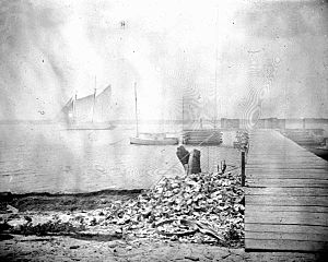
Lotus is a place in Brevard County, Florida, that used to be a small village. It's famous for Honeymoon Hill, which is the highest spot on Merritt Island. You can only get to Lotus by one road, called CR 3. This road connects to the Pineda Causeway from the south and State Road 520 from the north.
Today, Lotus is a nice residential area in Brevard County. Many homes here have amazing views of the Indian River and Banana River Lagoons. Back in the 1960s, when the Space Age began, Lotus and a nearby village called Tropic became part of the larger Merritt Island area. They changed to be only for single-family homes, so they lost their original village names.
Geography of Lotus
Lotus is located at 28°12′39″N 80°38′28″W / 28.21083°N 80.64111°W. The area covers about 11.08 miles (17.83 km). It sits between Honeymoon Hill and the Pineda Causeway. The part of Lotus around Honeymoon Hill is known as Fairyland.
Here are some places near Lotus:
- Georgiana

- Banana River, Patrick Space Force Base

- Tropic

- Pineda, Bonaventure

Honeymoon Hill: The Highest Point
Honeymoon Hill is the tallest spot on Merritt Island. It is also one of the highest points in all of Brevard County. This hill is about 35 feet (11 meters) tall at its very top. The top of the hill is right by Honeymoon Lake and the Banana River lagoon.
The area on the eastern side of Honeymoon Lake is called Fairyland. People named it Fairyland because it felt like being "up to the heavens." Fairyland is known for its beautiful homes. These homes sit high on the hill, looking out over South Tropical Trail, the lagoons, and the lake.
Honeymoon Hill is located at 28°16′27″N 80°39′59″W / 28.27417°N 80.66639°W.
Honeymoon Lake: A Historic Waterway
Quick facts for kids Honeymoon Lake |
|
|---|---|
| Location | Merritt Island, Florida |
| Coordinates | 28°16′13″N 80°40′08″W / 28.27028°N 80.66889°W |
| Basin countries | United States |
Honeymoon Lake is a lake that touches the areas of Georgiana, Fairyland, and Lotus. The lake has about 2.15 miles (3.46 km) of shoreline. There's a secret historic ferry passage here. This passage was used when this part of Merritt Island was first settled. It connects Honeymoon Lake to the Indian River lagoon. The lake is usually shallow, often less than chest deep.
Honeymoon Lake is located at 28°16′13″N 80°40′08″W / 28.27028°N 80.66889°W.
 | Kyle Baker |
 | Joseph Yoakum |
 | Laura Wheeler Waring |
 | Henry Ossawa Tanner |


