Louvigny, Sarthe facts for kids
Quick facts for kids
Louvigny
|
|
|---|---|
 |
|
| Country | France |
| Region | Pays de la Loire |
| Department | Sarthe |
| Arrondissement | Mamers |
| Canton | Mamers |
| Intercommunality | Maine Saosnois |
| Area
1
|
8.71 km2 (3.36 sq mi) |
| Population
(Jan. 2019)
|
172 |
| • Density | 19.75/km2 (51.15/sq mi) |
| Demonym(s) | Louvinois, Louvinoise |
| Time zone | UTC+01:00 (CET) |
| • Summer (DST) | UTC+02:00 (CEST) |
| INSEE/Postal code |
72170 /72600
|
| Elevation | 92–177 m (302–581 ft) |
| 1 French Land Register data, which excludes lakes, ponds, glaciers > 1 km2 (0.386 sq mi or 247 acres) and river estuaries. | |
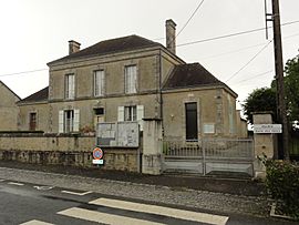
Louvigny is a small and charming commune located in the western part of France. It is found in the Pays de la Loire region, which is known for its beautiful landscapes and rich history. Louvigny is also part of the Sarthe department.
Contents
Discovering Louvigny
Louvigny is a great example of a typical French commune. A commune is the smallest type of local government area in France. Think of it like a town or a village with its own local council and mayor.
Where is Louvigny Located?
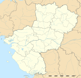
Louvigny is nestled in the Sarthe department. This department is part of the larger Pays de la Loire region. This region is in the west of France, not too far from the Atlantic coast.
The coordinates for Louvigny are about 48.3389 degrees North and 0.2028 degrees East. This helps us pinpoint its exact location on a map.
What is a Commune?
In France, a commune is like a local community. It has its own mayor and a town hall, called a mairie. The mayor and the local council help manage the daily life of the people living there. This includes things like local services and community events.
Louvigny, like many communes, has a small population. As of January 2019, about 172 people lived there. People from Louvigny are called Louvinois (for boys and men) or Louvinoise (for girls and women).
Geography and Landscape
Louvigny covers an area of about 8.71 square kilometers. That's roughly 3.36 square miles. The land in Louvigny is not completely flat. Its elevation ranges from 92 meters (about 302 feet) at its lowest point to 177 meters (about 581 feet) at its highest. This means there are some gentle hills and valleys in the area.
See also
 In Spanish: Louvigny (Sarthe) para niños


