Lowes Loch (Ayrshire) facts for kids
Quick facts for kids Lowes Loch or The Lochs |
|
|---|---|
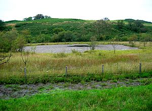
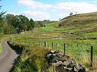
Lowes loch from near the Lochlands Farm site
|
|
| Lua error in Module:Location_map at line 420: attempt to index field 'wikibase' (a nil value). | |
| Location | Beith, North Ayrshire, Scotland |
| Type | Freshwater loch |
| Primary inflows | Cadgerford and Lochlands Burns, field drainage, and rainfall |
| Primary outflows | Cadgerford Burn running to the Dusk Water |
| Basin countries | Scotland |
| Islands | 1 |
| Settlements | Beith |
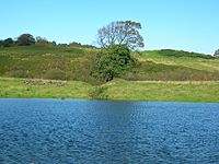
Lowes Loch, also known as The Lochs or Loch of Hill, is a small freshwater loch in North Ayrshire, Scotland. It sits in a natural dip in the land called a kettle hole, which was formed by melting ice from a glacier. The loch is located near the town of Beith. It used to be much larger and may have even had a small island in it.
Contents
The Lochs Site: A Changing Landscape
The area around Lowes Loch has changed a lot over time. Maps often call it 'The Lochs'. People who live nearby know it as Lowes Loch because it's on land once called 'Lowes Lands'.
Long ago, there might have been four separate small lochs here:
- One was in front of a building called Lows Cottage.
- Another was to the west of the loch we see today.
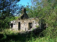
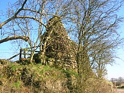
- A smaller fourth one, now mostly drained, was next to an old farm ruin.
The name 'Lowe' comes from an old Celtic word meaning 'Hill'. So, Lochlands Hill, which is nearby, was once known as Lowes Hill. The water level of the lochs used to be higher. This was before the Cadgerford Burn, a stream that flows into and out of the loch, was made deeper.
Lows Cottage: A Historic Building
Lows Cottage was originally a "retting" cottage. Retting is a process used to prepare flax plants. Later, it became a small farm with a barn for animals.
How Maps Show the Loch's History
Old maps help us understand how Lowes Loch has changed.
- A map from 1684, based on an even older map from 1604, shows a 'Loch of Hill'.
- A map from around 1747 shows two small lochs. The water from the western loch flowed into another stream.
- By 1832, a map shows only one loch, draining towards the east.
- Maps from the 1850s don't show much open water. A group of trees on these maps might suggest where a small island once was.
The Cadgerford Burn: A Key Waterway
The Cadgerford Burn is the stream that flows into and out of Lowes Loch. Its name comes from 'cadgers', who were people who carried goods on horseback, like Dunlop cheese, in the past. There was likely a ford (a shallow place to cross a river) on this old road.
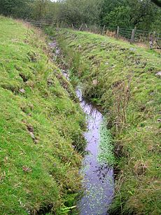
The burn has been made wider and much deeper. This was done to lower the water level of Lowes Loch. Today, the Cadgerford Burn flows into Kirkleegreen Reservoir. The water from this reservoir then goes into Cuffhill Reservoir and finally into the Dusk Water.
Uses of Lowes Loch Through Time
Lowes Loch and the surrounding area have been used for different purposes over the years.
Flax Retting: Preparing Plants for Cloth
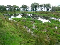
The small pond in front of Lows Cottage was a "retting pond". This is where flax plants were soaked in water to separate their fibers. These fibers were then used to make linen cloth. The cottage itself was built for this process. This small pond no longer has open water.
In the past, the loch's water flowed into a millpond at the old Threepwood Bleach and Dye works. This water helped power the factory's waterwheel. Since at least 1891, the loch's water has flowed into the Kirkleegreen and Cuffhill Reservoirs, which supply water to local areas.
Davie's o'the Mill: A Historic Mill Site
Davie's o'the Mill was likely an old flax mill. It was probably connected to the retting cottage and the bleach and dye works nearby. The ruins of this mill are still there today. It was once powered by a stream that flowed from a place called Saint Inan's well. Before the Cadgerford Burn was made deeper, water from the Lowes Lochs also flowed towards this mill.
A famous person named Dugald Semple lived at Davie's o'the Mill from the 1930s to around 1950. He was a vegetarian and believed in a simple way of life. People called him the 'Scottish Apostle of the simple life'. He traveled to many health conferences and was known locally as the 'Bird Man' because he loved outdoor living. He even wrote a book called A Free Man's Philosophy. He often welcomed walkers and cyclists to camp on his land.
Wildlife and Nature at Lowes Loch
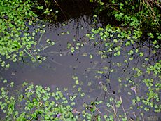
The small area of open water at Lowes Loch is home to various plants and animals.
- You can find floating pondweeds and water lilies (Nuphar lutea).
- The Common Hawker dragonfly (Aeshna juncea) breeds here.
- There's a large area of willow and birch trees nearby.
- You'll also see many rushes (a type of grass-like plant).
Lochlands Farms: Old Buildings and Discoveries
There were once two Lochlands Farms.
- A smaller building, now completely gone, was marked as a ruin in 1856. It sat in a wooded area near a small loch and a large drainage ditch that leads to Lowes Loch.
- The larger Lochlands Farm buildings were closer to the road. This farm has been empty since before the 1950s. A photo from the early 1900s shows it had an unusual design. It was more like a house than a farm and was owned by a family who ran a bus company. It was later taken down to help protect the reservoir water from pollution.
In 1956, a man named Mr. Newall found an old stone slab built into the ruins of Lochlands. It had a carved circle with a simple cross inside. This ancient stone cross might be linked to the nearby Kirklee Green, which has religious connections. The stone has not been seen since 1956.
It's thought that a small church might have been built near the original Lochlands building. This church may have been built to balance out the many ancient pagan sites on Cuff Hill, like stone circles and burial mounds. The name Cuff itself might mean 'Druid' or 'Priest'. Saint Inan's Well and Chair are also close by.
Local History and Interesting Facts
Some people believe that the Cuff Hill area was once called the "Wood of Belt". A battle might have happened here long ago, in the late 500s.
Curling stones were made near Kirklee Green Reservoir in the 1800s. It's said that many of these stones were used to help build the reservoir's dam.
An old cheese press stone can be seen outside Low Cottage.
Cuff Hill Lochan: A Small Pond with Wildlife
This small pond is on the side of Cuff Hill. It might be man-made, as there are many old stone quarries nearby. It was shown on maps from 1858 and was made deeper to be used as a reservoir, probably for The Cuff Farm below it. This area is full of wildlife, including Common Hawker dragonflies. A rare climbing plant called Ceratocapnos claviculata also grows nearby.
|
 | Laphonza Butler |
 | Daisy Bates |
 | Elizabeth Piper Ensley |


