Ludell, Kansas facts for kids
Quick facts for kids
Ludell, Kansas
|
|
|---|---|

|
|
| Country | United States |
| State | Kansas |
| County | Rawlins |
| Elevation | 2,782 ft (848 m) |
| Population
(2020)
|
|
| • Total | 41 |
| Time zone | UTC-6 (CST) |
| • Summer (DST) | UTC-5 (CDT) |
| ZIP code |
67744
|
| Area code | 785 |
| FIPS code | 20-43175 |
| GNIS ID | 470997 |
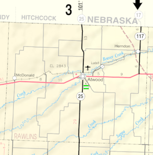
Ludell is a small community in Rawlins County, Kansas, United States. It's known as a census-designated place (CDP), which means it's an area identified by the U.S. Census Bureau for statistical purposes. In 2020, about 41 people lived there. Ludell is located about 5.5 miles (8.9 km) northeast of Atwood.
History of Ludell
Ludell has a post office that uses the ZIP code 67744. The first post office in Ludell opened way back in 1876. Interestingly, between 1876 and 1881, the post office had a few different names. It was called Danube, Kelso, or Prag for a while before settling on Ludell.
Who Lives in Ludell?
In 2020, the census counted 41 people living in Ludell. There were 15 households, and 9 of these were families. The community is quite small, with about 108 people per square mile. Most of the people living in Ludell are white. The community has a mix of ages, with some younger people, adults, and seniors.
Schools in Ludell
The public schools that serve the Ludell community are part of the Rawlins County USD 105 school district. This district provides education for students in the area.


