Ludworth Intake facts for kids
Quick facts for kids Ludworth Intake |
|
|---|---|

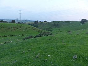
Ludworth Intake from a public footpath to the west
|
|
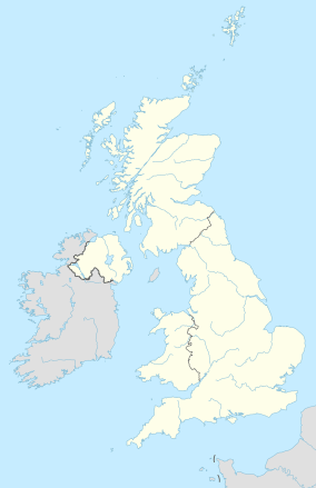
| Location | Greater Manchester, North West, England Derbyshire, East Midlands, England |
| Nearest town | Ludworth |
| Area | 5.1 ha (13 acres) |
| Established | 1998 |
| Governing body | Natural England |
| Website | Map of site |
Ludworth Intake is a special natural area in England. It covers about 5.1 hectares (which is like 12.6 acres). This site is located at Ludworth, right on the border between Derbyshire and Greater Manchester.
It's known as a Site of Special Scientific Interest (SSSI) because of its unique geology. This means it's a place that scientists study to understand Earth's history. Ludworth Intake was officially recognized as important in 1998.
Contents
Exploring Ludworth Intake's Geology
Ludworth Intake is a fascinating place for anyone interested in how our planet changes over time. It shows clear signs of how glaciers shaped the land thousands of years ago.
A Valley Shaped by Ice
This area features a winding, dry valley that stretches for about 400 meters. It cuts through a broad ridge of land that runs from east to west. Scientists believe this valley was formed by a stream of meltwater. This water would have flowed next to or even under a huge glacier.
The valley is considered an amazing example of a "col channel." This is a type of valley cut by glacial meltwater. It's very important for studying how glaciers affect landscapes.
How Old Is This Valley?
Scientists have studied pollen found at the site. By looking at the types of pollen, they can tell how old the channel is. Their research shows that this valley was formed before a cold period called the Younger Dryas. This cold snap happened about 12,900 to 11,700 years ago. This makes Ludworth Intake a very old and important geological site.
Location and Nearby Features
Ludworth Intake is located northeast of Marple Bridge and south of Chisworth. A public road, Sandhill Lane, runs alongside the eastern part of the valley. It also crosses the southern end of the valley. Near this southern end was the former Ludworth Moor Colliery, which was a coal mine that stopped operating in the early 1980s.
 | John T. Biggers |
 | Thomas Blackshear |
 | Mark Bradford |
 | Beverly Buchanan |


