Lurand, Mississippi facts for kids
Quick facts for kids
Lurand, Mississippi
|
|
|---|---|

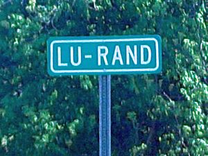
Lu-Rand Highway Sign on U.S. Route 49.
|
|
| Country | United States |
| State | Mississippi |
| County | Coahoma |
| Elevation | 157 ft (48 m) |
| Time zone | UTC-6 (Central (CST)) |
| • Summer (DST) | UTC-5 (CDT) |
| Area code(s) | 662 |
| GNIS feature ID | 672960 |
Lurand is a small place in Coahoma County, Mississippi, in the United States. It is known as an "unincorporated community." This means it's a group of homes or buildings that doesn't have its own local government, like a city or town does. Instead, it's governed by the larger county it's part of.
Lurand is located right on U.S. Route 49, which is a major highway. It's about 2 miles (3.2 kilometers) south of a larger city called Clarksdale.
About Lurand
Lurand is a quiet community in the heart of the Mississippi Delta region. It sits at an elevation of about 157 feet (48 meters) above sea level. This area is known for its flat land and rich soil, which is great for farming.
What is an Unincorporated Community?
An unincorporated community like Lurand is a place where people live close together, but it's not officially a city or town. It doesn't have a mayor or a city council. Instead, the county government, in this case, Coahoma County, provides services like roads, police, and fire protection for the residents.
Location and Surroundings
Lurand's location on U.S. Route 49 makes it easy to access. This highway is an important route that connects many towns and cities in Mississippi. Being close to Clarksdale means residents can easily get to bigger stores, schools, and other services.
 | DeHart Hubbard |
 | Wilma Rudolph |
 | Jesse Owens |
 | Jackie Joyner-Kersee |
 | Major Taylor |


