Lyona, Kansas facts for kids
Quick facts for kids
Lyona, Kansas
|
|
|---|---|

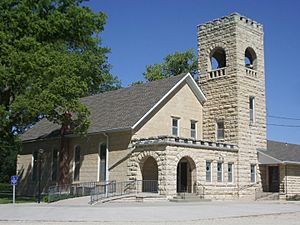
Lyona United Methodist Church (2011)
|
|

|
|
| Country | United States |
| State | Kansas |
| County | Dickinson |
| Elevation | 1,152 ft (351 m) |
| Time zone | UTC-6 (CST) |
| • Summer (DST) | UTC-5 (CDT) |
| Area code | 785 |
| FIPS code | 20-43510 |
| GNIS ID | 484795 |
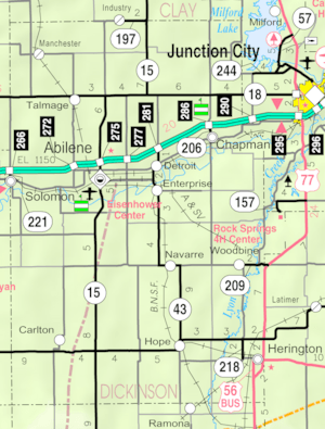
Lyona is a small, quiet place in Kansas, United States. It's what we call an unincorporated community. This means it's a group of homes and buildings that isn't officially a town or city with its own local government. Lyona is located in Liberty Township, which is part of Dickinson County, Kansas.
You can find Lyona on Wolf Road. It's about 8.7 miles (14.0 km) southwest of Junction City and 12.3 miles (19.8 km) north of Herington. It's also just 1.5 miles (2.4 km) west of the Rock Springs 4-H Camp, a popular place for youth activities.
History of Lyona
Lyona has a bit of history, even though it's a small community. Long ago, it had its own post office. A post office is where people would send and receive letters and packages. This post office served the community for some time, but it eventually closed down in 1888.
Education in Lyona
Students who live in Lyona attend schools that are part of the Chapman USD 473 public school district. A public school district is a local organization that manages and operates public schools in a specific area, making sure children have access to education.
 | Sharif Bey |
 | Hale Woodruff |
 | Richmond Barthé |
 | Purvis Young |


