Méré, Yonne facts for kids
Quick facts for kids
Méré
|
|
|---|---|
| Country | France |
| Region | Bourgogne-Franche-Comté |
| Department | Yonne |
| Arrondissement | Auxerre |
| Canton | Ligny-le-Châtel |
| Area
1
|
11.86 km2 (4.58 sq mi) |
| Population
(2006)
|
202 |
| • Density | 17.03/km2 (44.11/sq mi) |
| Time zone | UTC+01:00 (CET) |
| • Summer (DST) | UTC+02:00 (CEST) |
| INSEE/Postal code |
89250 /89144
|
| Elevation | 140–228 m (459–748 ft) |
| 1 French Land Register data, which excludes lakes, ponds, glaciers > 1 km2 (0.386 sq mi or 247 acres) and river estuaries. | |
Méré is a small and charming commune located in the heart of France. A commune is like a local town or village area with its own local government. Méré is part of the Yonne department. A department is similar to a county or a larger administrative region within France.
Contents
Exploring Méré: A French Commune
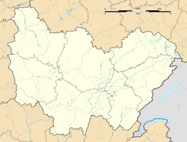
Méré is a lovely place in the Yonne department. It is found in the central part of France. This area is known for its beautiful countryside and rich history.
What is a Commune?
In France, a commune is the smallest unit of local government. It is like a town or a village. Each commune has a mayor and a local council. They help manage things like local services and public spaces. Méré is one of many communes in France.
Where is Méré Located?
Méré is situated in the Auxerre arrondissement. An arrondissement is a smaller division within a department. It helps organize local administration. Méré is also part of the Ligny-le-Châtel canton. A canton groups several communes together for elections.
Facts and Figures About Méré
Méré covers an area of about 11.86 square kilometers. That's roughly 4.5 square miles. In 2006, the population of Méré was 202 people. This makes it a very small and quiet community. The land in Méré ranges in height from 140 meters (459 feet) to 228 meters (748 feet) above sea level.
See also
 In Spanish: Méré (Yonne) para niños


