MacKay, Alberta facts for kids
Quick facts for kids
MacKay
|
|
|---|---|
|
Locality
|
|
| Country | Canada |
| Province | Alberta |
| Municipal district | Yellowhead County |
| Hamlet designation | May 14, 1979 |
| Hamlet repeal | February 26, 2016 |
| Area
(2021)
|
|
| • Land | 0.02 km2 (0.008 sq mi) |
| Population
(2021)
|
|
| • Total | 10 |
| • Density | 512.8/km2 (1,328/sq mi) |
| Time zone | UTC−7 (MST) |
| • Summer (DST) | UTC−6 (MDT) |
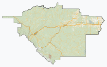
MacKay is a small place in west-central Alberta, Canada. It is part of Yellowhead County. You can find MacKay on the Yellowhead Highway (also known as Highway 16). It is about 57 kilometers (35 miles) east of a town called Edson.
MacKay is recognized as a "designated place" by Statistics Canada. This means it is a specific area they count for population. It used to be called a hamlet from 1979 until 2019. A hamlet is a very small community, usually smaller than a village.
History of MacKay
MacKay became known as a hamlet on May 14, 1979. The government of Alberta gave it this title. This was done so MacKay could get money to fix its streets.
However, on February 26, 2019, Yellowhead County decided to remove its hamlet status. So, MacKay is no longer officially a hamlet.
Population of MacKay
The number of people living in MacKay is counted by Statistics Canada. This happens during the census, which is like a big count of everyone in the country.
In 2021, MacKay had a population of 10 people. These 10 people lived in 4 homes. There were 9 homes in total in MacKay at that time. This population number was the same as in 2016.
In the 2016 census, MacKay also had 10 people. They lived in 7 homes out of 12 total homes. This was an increase from 2011, when only 5 people lived in MacKay.
MacKay is a very small area, only 0.02 square kilometers (0.0077 square miles). This means that in 2021, there were about 512 people per square kilometer.
 | Stephanie Wilson |
 | Charles Bolden |
 | Ronald McNair |
 | Frederick D. Gregory |


