Mahaica River facts for kids
Quick facts for kids Mahaica River |
|
|---|---|
|
Location of mouth
|
|
| Country | Guyana |
| Region | Demerara-Mahaica, Mahaica-Berbice |
| Physical characteristics | |
| River mouth | Atlantic Ocean Mahaica 6°43′N 57°55′W / 6.717°N 57.917°W |
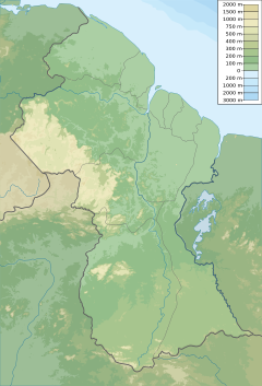
The Mahaica River is a small river in northern Guyana. It flows into the Atlantic Ocean. The village of Mahaica is located right where the river meets the ocean.
This river is one of the main streams along Guyana's coast. It also helps form a border between two regions: Demerara-Mahaica and Mahaica-Berbice. Saltwater from the ocean can travel up the river about 12 miles inland.
It can be tricky to find the exact start of the Mahaica River. This is because its upper parts mix with the lower parts of the Demerara and Berbice rivers. The river also splits into many smaller streams, making it seem endless.
Wildlife Along the River
The Mahaica River is a fantastic place for watching birds. Over 150 different types of birds can be found here! It is also home to other amazing animals. You might spot river otters or howler monkeys. The Canje Pheasant, which is Guyana's national bird, also lives here.
How People Use the River
People living along the lower parts of the Mahaica River mostly work in farming. Rice is the main crop they grow. However, the river often floods, which can be a big problem for farmers.
To help with flooding, the Bellamy Canal was dug in 1954. This canal connects the Mahaica River to the Mahaicony River. It helps control the amount of water flowing out of the river, especially during heavy rains. This prevents the coastal areas from flooding. Another canal, the Rutherford Canal, connects Mahaica to Broom Hall.
In 1978, a group called the Mahaica, Mahaicony, Abary-Agricultural Development Authority was created. This group helps encourage farming in a way that is good for the environment. They work between the Berbice and Mahaica Rivers. Their job is to build and manage all the drainage and irrigation systems in the Mahaica-Berbice region.
The Hope Canal was built to reduce flooding by moving water into the Mahaica River. This idea came after a huge flood in Georgetown in 2005. When the East Demerara Water Conservancy has too much water, special gates called sluices (Lama and Maduni) open to let water into the Mahaica River. In 2011, a wall made of boulders was built to protect farms from high tides.
In 2020, there were plans announced for a large new project along the river.
Communities on the River
St. Cuthbert's Mission is an important Amerindian community located along the Mahaica River.
See also
 In Spanish: Río Mahaica para niños
- List of rivers of Guyana
- List of rivers of the Americas by coastline
- Agriculture in Guyana


