Maná, Corozal, Puerto Rico facts for kids
Quick facts for kids
Maná
|
|
|---|---|
|
Barrio
|
|

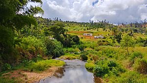
Río Grande de Manatí in Maná
|
|

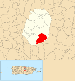
Location of Maná within the municipality of Corozal shown in red
|
|
| Commonwealth | |
| Municipality | |
| Area | |
| • Total | 3.86 sq mi (10.0 km2) |
| • Land | 3.86 sq mi (10.0 km2) |
| • Water | 0 sq mi (0 km2) |
| Elevation | 1,785 ft (544 m) |
| Population
(2010)
|
|
| • Total | 2,093 |
| • Density | 542.2/sq mi (209.3/km2) |
| Source: 2010 Census | |
| Time zone | UTC−4 (AST) |
Maná is a lovely rural area, or 'barrio,' located in the town of Corozal, Puerto Rico. It's a quiet place where about 2,093 people lived in 2010.
Contents
History of Maná
Maná was once listed in official Spanish records, known as 'gazetteers.' This was before Puerto Rico became a territory of the United States. This change happened after the Spanish–American War in 1898. The war ended with the Treaty of Paris of 1898.
In 1899, the United States government took a count of the people in Puerto Rico. This count, called a census, found that 1,133 people lived in Maná at that time.
Geography and Population of Maná
Maná covers about 3.86 square miles of land. It does not have any large bodies of water within its area.
In 2010, the population of Maná was 2,093 people. This means there were about 542 people living in each square mile. This number is called the population density.
The main road that goes through Maná from east to west is called PR-802.
Population Changes Over Time
The number of people living in Maná has changed over many years. Here's a look at how the population has grown or shrunk during different census years:
| Historical population | |||
|---|---|---|---|
| Census | Pop. | %± | |
| 1900 | 1,133 | — | |
| 1910 | 1,246 | 10.0% | |
| 1920 | 1,061 | −14.8% | |
| 1930 | 1,111 | 4.7% | |
| 1940 | 1,292 | 16.3% | |
| 1950 | 1,159 | −10.3% | |
| 1980 | 1,257 | — | |
| 1990 | 1,761 | 40.1% | |
| 2000 | 2,014 | 14.4% | |
| U.S. Decennial Census 1899 (shown as 1900) 1910-1930 1930-1950 1980-2000 2010 |
|||
Sectors in Maná
In Puerto Rico, 'barrios' are like small towns or districts. These barrios are then divided into even smaller areas. These smaller areas are called sectores (which means 'sectors' in English).
The types of sectors can be different. Some are simply called 'sector.' Others might be called 'urbanización' (a planned neighborhood), 'reparto' (a land division), 'barriada' (a neighborhood), or 'residencial' (a residential area).
Here are the different sectors you can find in Maná barrio:
- Sector Andreu
- Sector Estancias de Maná
- Sector Ferdinand Santiago
- Sector La Escuela
- Sector La Vega
- Sector Los Berríos
- Sector Los Berros
- Sector Los Lozada
- Sector Los Pilones
- Sector Los Zayas
- Sector Manchuria
- Sector Monchito Pérez
- Sector Pocito Dulce
- Sector Quebrada Fría
- Sector Varo Mercado
- Sector William Alvarado
See also
 In Spanish: Maná (Corozal) para niños
- List of communities in Puerto Rico
- List of barrios and sectors of Corozal, Puerto Rico
 | Mary Eliza Mahoney |
 | Susie King Taylor |
 | Ida Gray |
 | Eliza Ann Grier |


