Mana, New Zealand facts for kids
Quick facts for kids Mana |
|
|---|---|

Mana Peninsula
|
|
| Basic information | |
| Local authority | Porirua |
| Coordinates | 41°05′51″S 174°52′10″E / 41.097548°S 174.869463°E |
| Facilities | |
| Train station(s) | Mana Railway Station |
|
|
||
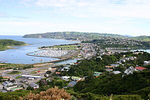
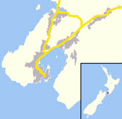
Mana is a small area in Porirua City, New Zealand. It is part of the Paremata suburb. Mana is like a narrow strip of land. It has water on both sides. To the west is the entrance to Porirua Harbour. To the east is the Pauatahanui inlet, which is also part of Porirua Harbour. Mana Island is also nearby. It lies about three kilometers west of Mana.
Important transport routes run through Mana. State Highway 59 and the North Island Main Trunk railway both go right through the middle. State Highway 59 used to be part of State Highway 1. But on December 7, 2021, State Highway 1 moved to the Transmission Gully Motorway.
Around 2005-2006, traffic flow through Mana got much better. A second bridge was added to the state highway at the southern end. Special lanes for buses and carpools, called transit lanes, were also put in. Several new traffic lights helped manage the cars. These changes were part of a big upgrade project from Plimmerton to Paremata.
History of Mana
Mana was once known by a different name. Before 1960, people called the area Dolly Varden. This name came from a ship.
However, local people wanted a change. They pushed for the area to be renamed Mana. Their efforts worked, and in 1960, the name was officially changed to Mana.
 | Charles R. Drew |
 | Benjamin Banneker |
 | Jane C. Wright |
 | Roger Arliner Young |


