Manson, North Carolina facts for kids
Quick facts for kids
Manson, North Carolina
|
|
|---|---|
 |
|
| Country | United States |
| State | North Carolina |
| County | Warren |
| Elevation | 423 ft (129 m) |
| Time zone | UTC-5 (Eastern (EST)) |
| • Summer (DST) | UTC-4 (EDT) |
| ZIP code |
27553
|
| Area code(s) | 252 |
| GNIS feature ID | 989290 |
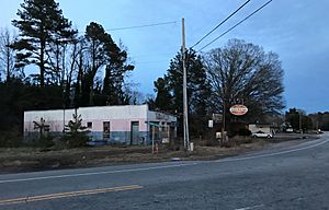
Manson is a small, quiet community located in Warren County, North Carolina, in the United States. It's known as an "unincorporated community," which means it doesn't have its own local government like a city or town. Instead, it's managed by the county. Manson is situated about 5 miles (8 km) west-southwest of Norlina and is near U.S. Route 1, a major road. This community has its own post office with the ZIP code 27553.
Contents
Discovering Manson, North Carolina
Manson is a peaceful spot in North Carolina. It offers a glimpse into the state's rural life. Being an unincorporated community, it relies on Warren County for services. This includes things like roads and public safety.
A Look at Manson's History
The area we now call Manson has a rich history. It has changed names several times over the years. Each name change tells a part of its story.
Early Beginnings: Cheathamville
Originally, this community was known as Cheathamville. This was its first recorded name. We don't know much about why it was called this.
The Railroad Brings Change: Branchville
In 1858, something important happened. A branch of the Roanoke Valley Railway connected with the Raleigh and Gaston Railroad right here. This new rail connection was a big deal for the community. Because of this, the name changed to Branchville. The railroad helped people and goods move around.
Honoring a Local Doctor: Mason
Just one year later, in 1859, the community changed its name again. This time, it was renamed Mason. This new name honored O. F. Mason, who was a respected local doctor. It shows how important community leaders were back then.
Becoming Manson: A Final Name Change
The community was officially "incorporated" in 1874. This means it was given a legal status as a town. However, over time, the local government activities became less active. Eventually, the name evolved to Manson, which is what we know it as today.
Historic Places in Manson
Manson is home to at least one important historic site. These sites help us remember the past.
The Green Duke House
The Green Duke House is a special building in Manson. It was recognized for its historical importance in 1974. It was added to the National Register of Historic Places. This list includes places across the country that are worth preserving. They tell stories about America's past.
 | Mary Eliza Mahoney |
 | Susie King Taylor |
 | Ida Gray |
 | Eliza Ann Grier |


