
Mapaville, Missouri facts for kids
Quick facts for kids
Mapaville, Missouri
|
|
|---|---|
 |
|
| Country | United States |
| State | Missouri |
| County | Jefferson |
| Time zone | UTC-6 (Central (CST)) |
| • Summer (DST) | UTC-5 (CDT) |
| Area code(s) | 636 |
Mapaville is a small, unincorporated community in Jefferson County, Missouri, United States. It is not an official town or city. Mapaville is located about halfway between the towns of Festus and Hillsboro. You can find it where two roads, Route A and Route Z, meet.
Contents
Exploring Mapaville's Location
Mapaville is found in the eastern part of Missouri. This area is known for its rolling hills and forests. Being in Jefferson County means it's part of a larger region. This region has a mix of small communities and natural areas.
Where is Mapaville on the Map?
Mapaville is in the United States. It's in the state of Missouri. Within Missouri, it's located in Jefferson County. Its exact coordinates are 38 degrees, 14 minutes, 56 seconds North and 90 degrees, 29 minutes, 0 seconds West. These numbers help pinpoint its spot on any map.
Getting Around Mapaville
The community is connected by two main roads. These are Missouri Route A and Missouri Route Z. These routes help people travel to and from Mapaville. They also connect it to nearby towns like Festus and Hillsboro. These roads are important for daily life and transportation.
What is an Unincorporated Community?
Mapaville is an unincorporated community. This means it does not have its own local government. It doesn't have a mayor or a city council. Instead, it is governed by the county. In this case, Jefferson County handles services for Mapaville.
How Unincorporated Areas Work
In an unincorporated community, county officials manage things. They take care of services like roads and public safety. Residents still pay taxes. These taxes go to the county for services. This is different from a city, which has its own local government.
Life in Jefferson County
Mapaville is part of Jefferson County. This county has a rich history and many natural features. It's located south of St. Louis. The county offers a mix of rural and suburban living.
Natural Beauty Nearby
Jefferson County has many parks and outdoor spaces. These areas offer chances for hiking, fishing, and exploring nature. The Mississippi River forms part of the county's eastern border. This provides scenic views and recreational activities.
Education and Schools
Children living in Mapaville attend schools in nearby districts. These schools are part of the public education system. They provide learning opportunities for students from kindergarten through high school.
Images for kids
-
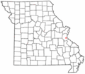
A map showing the location of Mapaville in Missouri.
