March Route of Rochambeau's Army: Palmer Road facts for kids
|
March Route of Rochambeau's Army: Palmer Road
|
|

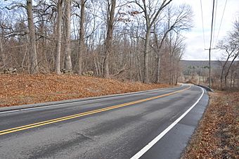
Palmer Road in 2016
|
|
| Location | Palmer Rd, from intersection with Miller Rd. to E of jct. with Pudding Hill Rd., Scotland, Connecticut |
|---|---|
| Area | 2.6 acres (1.1 ha) |
| MPS | Rochambeau's Army in Connecticut, 1780-1782 MPS |
| NRHP reference No. | 03000311 |
Quick facts for kids Significant dates |
|
| Dates of significance | 1781, 1782 |
| Added to NRHP | June 6, 2003 |
The March Route of Rochambeau's Army: Palmer Road is a special historic area in Scotland, Connecticut. It includes a part of Connecticut Route 14, also known as Palmer Road. This road was added to the National Register of Historic Places in 2003. It's important because it still looks much like it did when the French Army, led by General Rochambeau, marched along it during the American Revolutionary War in 1781 and 1782.
A Historic Road: Palmer Road
Connecticut Route 14 is a very old road that goes through the eastern part of Connecticut. It passes through the small village of Scotland. During the American Revolutionary War, Scotland was actually part of a bigger town called Windham. It became its own town much later, in 1857.
This road, Palmer Road, was a key path for Rochambeau's French troops. They used it in 1781 when they were marching west from Providence, Rhode Island, towards Yorktown, Virginia. They also used it again in 1782 on their way back. French soldiers who wrote about the march said that the road east of Scotland was narrow, steep, and very stony. Their heavy wagons often arrived late at their camp in Windham because of how tough the road was.
What Made This Road Special?
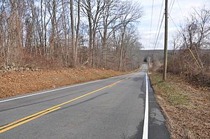
The historic part of Palmer Road is about 2,000 feet (610 meters) long. It starts at Miller Road and goes east past Pudding Hill Road. Even though it's now a modern paved road, it still has many of the same features the French soldiers described. It rises steadily and sometimes steeply, just as they noted.
You can also see old stone walls along much of the road. These walls are typical of New England and were also mentioned by the French writers. When you look out from the road, you'll see hundreds of acres of farmland, surrounded by these stone walls and trees. This view is very similar to what Rochambeau's army would have seen more than 200 years ago.
About 3 miles (4.8 km) east along Route 14, there's another preserved section of Rochambeau's march route. This part is about 1,400 feet (430 meters) long and is along a bypass of Route 14. Many other places connected to Rochambeau's route have also been studied for their historical importance.
 | Precious Adams |
 | Lauren Anderson |
 | Janet Collins |


