
Mareham Lane facts for kids
Mareham Lane is a road in Lincolnshire, England. It stretches for about 10.6 miles (17.1 kilometers) between Graby and Sleaford. What makes this road special is that for most of its length, it follows the path of an ancient Roman road!
The Ancient Roman Road
Imagine a road built thousands of years ago by the Romans! Mareham Lane mostly follows one of these old Roman roads. This Roman road stretched from a town called Bourne all the way to Sleaford, where there was an old river crossing (a ford). It might even have continued further north to the city of Lincoln, which the Romans called Lindum Colonia. These roads were super important for the Romans to travel and move goods across Britain.
How Roman Roads are Classified
Historians like Ivan Margary have studied Roman roads and given them special numbers to help identify them. It's like a catalog for ancient roads! He gave these parts of the Roman road the following numbers:
- RR260 Bourne-Sleaford
- RR262 Sleaford-Bracebridge Heath
-
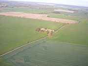
Beacon Hill farm on Mareham Lane
-
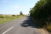
Mareham Lane near Scredington
-
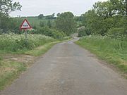
Ford just north of Graby
-
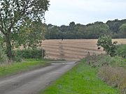
Roman Alignment through cornfield


.jpg)
