Margate, Tasmania facts for kids
Quick facts for kids MargateTasmania |
|
|---|---|
| Population | 3,920 (2016 census) |
| Postcode(s) | 7054 |
| Location |
|
| LGA(s) | Kingborough |
| State electorate(s) | Franklin |
| Federal Division(s) | Franklin |
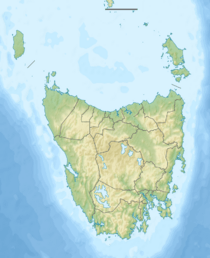
Margate is a lovely seaside town in Tasmania, Australia. It is located on the Channel Highway, about 7 kilometers (4.3 miles) south of Kingston. The town sits between North-West Bay and the Snug Tiers. Most of Margate is part of the Kingborough Council area. It is also considered part of the larger Hobart region.
Contents
Exploring Margate: What's There?
Margate is a growing town with a population of 3,920 people as of 2016. It's a popular stop for people traveling south towards places like Snug or Bruny Island. The area around Margate is very pretty, with vineyards, green fields, and forests.
Town Facilities and Growth
In Margate itself, you'll find a variety of shops, schools, and churches. The town has grown quite a bit in recent years, with many new houses being built. A lot of people who live in Margate travel to Hobart for work. Others work locally in businesses like the Tassal fish factory or the Austal shipyard, which builds ships.
Margate Primary School received a lot of money in 2009 for new buildings. This helped improve the school for local students. A fun fact about Margate is that its residents were once found to be the "happiest in the state" in a health survey!
Fun Places to Visit in Margate
One of the most interesting spots in Margate is the Margate Train. This is an old train, called MA3, from the Tasmanian Government Railways. It's parked just off the Channel Highway. The train carriages have been turned into unique shops and even a pancake cafe! It's next to an old apple barn that is now a second-hand and antique store.
Another great place to visit is the Channel Heritage Centre. This museum tells the story of life in the area around the D'Entrecasteaux Channel. It's a fantastic way to learn about the history of Margate and its surroundings. You can also enjoy Dru Point Bicentennial Park, which is right on the edge of North-West Bay.
Margate's Past: A Brief History
The area where Margate is located has a rich history. In 1792, a French explorer named Bruni D'Entrecasteaux sailed up the channel that is now named after him. He mapped the coastline and named North-West Bay. His team anchored there to get fresh water. They saw many Aboriginal Tasmanians living in the area.
In 1802, another French explorer, Nicolas Baudin, also anchored in the bay. His ships stayed for a while to collect water, food, and wood. They even set up an observatory on a small island to watch a solar eclipse. They also met several Aboriginal people during their stay.
Early Settlement and Development
The original town of Margate was built along Beach Road. This was because coal-burning ships would bring all the supplies by sea. The Margate Post Office first opened on July 1, 1866. The primary school started in 1869.
From 1906 to 1922, a special railway called the Sandfly Colliery Tramway ran from Margate Wharf to a coal mine. The jetty (a pier for boats) was about 80 meters (260 feet) long. It was deep enough for ships that needed about 7 meters (23 feet) of water.
In June and July of 2016, Margate celebrated its 150th birthday! The town held a week of festivals and celebrations to mark this special occasion.
 | Aurelia Browder |
 | Nannie Helen Burroughs |
 | Michelle Alexander |


