Marion Heights, Indiana facts for kids
Quick facts for kids
Marion Heights, Indiana
|
|
|---|---|

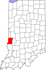
Vigo County's location in Indiana
|
|
| Country | United States |
| State | Indiana |
| County | Vigo |
| Township | Sugar Creek |
| Elevation | 495 ft (151 m) |
| Time zone | UTC-5 (Eastern (EST)) |
| • Summer (DST) | UTC-4 (EDT) |
| ZIP code |
47885
|
| Area code(s) | 812, 930 |
| GNIS feature ID | 438617 |
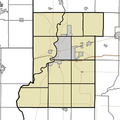
Marion Heights is a small place in Indiana, United States. It's called an "unincorporated community." This means it's a group of homes and businesses that isn't officially a town or city with its own local government. Instead, it's part of a larger area called Sugar Creek Township in Vigo County.
Marion Heights is also part of the Terre Haute metropolitan area. A metropolitan area is a big region that includes a main city (like Terre Haute) and all the smaller towns and communities around it. People in these areas often share services and jobs.
Where is Marion Heights?
Marion Heights is located in the western part of Indiana. You can find it at these exact coordinates: 39°29′41″N 87°26′45″W / 39.49472°N 87.44583°W.
Elevation of Marion Heights
The elevation of Marion Heights is about 495 feet (or 151 meters) above sea level. Elevation tells you how high a place is compared to the ocean's surface.
 | Lonnie Johnson |
 | Granville Woods |
 | Lewis Howard Latimer |
 | James West |


