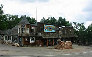
Masonville, Colorado facts for kids
Quick facts for kids
Masonville, Colorado
|
|
|---|---|

General store in Masonville
|
|
| Country | |
| State | |
| County | Larimer |
| Elevation | 5,387 ft (1,642 m) |
| Time zone | UTC-7 (MST) |
| • Summer (DST) | UTC-6 (MDT) |
| ZIP code |
80541
|
| Area code(s) | 970 |
| GNIS feature ID | 0204676 |
Masonville is a small place in Larimer County, Colorado, United States. It's known as an unincorporated community. This means it's a group of homes and businesses that aren't officially part of a city or town. Instead, it's managed by the county government. Masonville also has its own U.S. Post Office, which helps people send and receive mail. The special code for mail in Masonville is ZIP Code 80541.
Where is Masonville Located?
Masonville is found in the beautiful state of Colorado. It sits at a specific spot on the Earth, which scientists and mapmakers call its coordinates. These coordinates are 40°29′14″N 105°12′36″W / 40.48722°N 105.21000°W. This means it's about 40 degrees north of the equator and 105 degrees west of the prime meridian. It's nestled in a scenic area of Larimer County.
 | Delilah Pierce |
 | Gordon Parks |
 | Augusta Savage |
 | Charles Ethan Porter |


