Matamoras, Indiana facts for kids
Quick facts for kids
Matamoras, Indiana
|
|
|---|---|

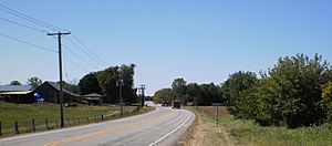
West entrance of Matamoras, Indiana
|
|

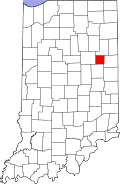
Blackford County's location in Indiana
|
|
| Country | United States |
| State | Indiana |
| County | Blackford |
| Township | Harrison |
| Established | circa 1833 |
| Elevation | 869 ft (265 m) |
| Time zone | UTC-5 (Eastern (EST)) |
| • Summer (DST) | UTC-4 (EDT) |
| ZIP code |
47359
|
| Area code(s) | 765 |
| FIPS code | 18-47550 |
| GNIS feature ID | 438709 |
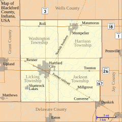
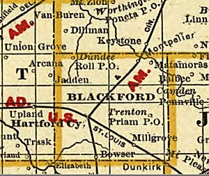
Matamoras is a small, unincorporated community located in the northeast part of Harrison Township, within Blackford County, in the U.S. state of Indiana. It is the oldest community in Blackford County, even though it wasn't the first area to be officially mapped out.
Where is Matamoras?
Matamoras is found right by the Salamonie River. It is less than one mile east of the town of Montpelier.
A Glimpse into Matamoras's Past
This community was likely named after a city in Mexico called Matamoros. That Mexican city was famous for being a battleground during the Mexican–American War.
Black History Month on Kiddle
African-American Ballerinas:
 | Precious Adams |
 | Lauren Anderson |
 | Janet Collins |

All content from Kiddle encyclopedia articles (including the article images and facts) can be freely used under Attribution-ShareAlike license, unless stated otherwise. Cite this article:
Matamoras, Indiana Facts for Kids. Kiddle Encyclopedia.


